
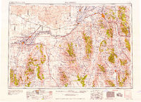
~ Pocatello ID topo map, 1:250000 scale, 1 X 2 Degree, Historical, 1958
Pocatello, Idaho, USGS topographic map dated 1958.
Includes geographic coordinates (latitude and longitude). This topographic map is suitable for hiking, camping, and exploring, or framing it as a wall map.
Printed on-demand using high resolution imagery, on heavy weight and acid free paper, or alternatively on a variety of synthetic materials.
Topos available on paper, Waterproof, Poly, or Tyvek. Usually shipping rolled, unless combined with other folded maps in one order.
- Product Number: USGS-5437700
- Free digital map download (high-resolution, GeoPDF): Pocatello, Idaho (file size: 21 MB)
- Map Size: please refer to the dimensions of the GeoPDF map above
- Weight (paper map): ca. 55 grams
- Map Type: POD USGS Topographic Map
- Map Series: HTMC
- Map Verison: Historical
- Cell ID: 68963
- Scan ID: 239660
- Woodland Tint: Yes
- Aerial Photo Year: 1955
- Field Check Year: 1954
- Datum: Unstated
- Map Projection: Transverse Mercator
- Map published by United States Army Corps of Engineers
- Map published by United States Army
- Map Language: English
- Scanner Resolution: 600 dpi
- Map Cell Name: Pocatello
- Grid size: 1 X 2 Degree
- Date on map: 1958
- Map Scale: 1:250000
- Geographical region: Idaho, United States
Neighboring Maps:
All neighboring USGS topo maps are available for sale online at a variety of scales.
Spatial coverage:
Topo map Pocatello, Idaho, covers the geographical area associated the following places:
- Inkom - Arimo - Rockland - Strevell - Lava Hot Springs - Minidoka - Ireland Springs - Oxford - Arbon - McCammon - Marsh Valley - Pleasantview - Schiller - Fairview - Bridge - Tyhee - Stone - Pocatello - Hawkins - Black Pine - Trout - Downey - Holbrook - Connor - Virginia - Roy Summit - Juniper - Roy - Unity - Crystal - Nelson (historical) - Hobson - Holbrook Summit - Hazel (historical) - Beetville - Springdale - Smith Springs - Saint Johns - Albion - Idahome - Quigley - Elba - Hynes - Malad City - Topaz (historical) - Kelso - Blackrock - Keogh - Pella - Clifton - Jackson - Travers - Buist - Ridgedale - Don - Dairy Creek - Naf - Declo - Tipton (historical) - Neeley - Portneuf - Lone Rock - Budge - Michaud - Zenda - Cream Can Junction - DeWoff - Rupert - Paul - Heyburn - Hawley - Malta - American Falls - Adelaide - Myers - Norland - Cambridge - Alameda - View - Pauline - Pebble - Schodde - Robin - Schow - Sublett - Marion - Almo - Downata Hot Springs - Fingal - Burley - North Kenyon - Cherry Creek - Chubbuck - Gwenford - Oakley - Ruby - Acequia - Conant - Wapi - Amalga
- Map Area ID: AREA4342-114-112
- Northwest corner Lat/Long code: USGSNW43-114
- Northeast corner Lat/Long code: USGSNE43-112
- Southwest corner Lat/Long code: USGSSW42-114
- Southeast corner Lat/Long code: USGSSE42-112
- Northern map edge Latitude: 43
- Southern map edge Latitude: 42
- Western map edge Longitude: -114
- Eastern map edge Longitude: -112


