
~ Grangeville ID topo map, 1:250000 scale, 1 X 2 Degree, Historical, 1955, updated 1979
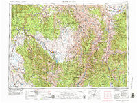
Grangeville, Idaho, USGS topographic map dated 1955.
Includes geographic coordinates (latitude and longitude). This topographic map is suitable for hiking, camping, and exploring, or framing it as a wall map.
Printed on-demand using high resolution imagery, on heavy weight and acid free paper, or alternatively on a variety of synthetic materials.
Topos available on paper, Waterproof, Poly, or Tyvek. Usually shipping rolled, unless combined with other folded maps in one order.
- Product Number: USGS-5437668
- Free digital map download (high-resolution, GeoPDF): Grangeville, Idaho (file size: 27 MB)
- Map Size: please refer to the dimensions of the GeoPDF map above
- Weight (paper map): ca. 55 grams
- Map Type: POD USGS Topographic Map
- Map Series: HTMC
- Map Verison: Historical
- Cell ID: 68802
- Scan ID: 239640
- Imprint Year: 1979
- Woodland Tint: Yes
- Visual Version Number: 1
- Aerial Photo Year: 1978
- Edit Year: 1979
- Field Check Year: 1955
- Datum: Unstated
- Map Projection: Transverse Mercator
- Map published by: Military, Other
- Map Language: English
- Scanner Resolution: 600 dpi
- Map Cell Name: Grangeville
- Grid size: 1 X 2 Degree
- Date on map: 1955
- Map Scale: 1:250000
- Geographical region: Idaho, United States
Neighboring Maps:
All neighboring USGS topo maps are available for sale online at a variety of scales.
Spatial coverage:
Topo map Grangeville, Idaho, covers the geographical area associated the following places:
- Fruita - Fenn - Grossman (historical) - Alder (historical) - Copper (historical) - Pinehurst - Paradise - Joseph - Wallowa - Denver - Alicel - Medical Springs - Cabin Creek (historical) - Grangeville - McCrea Place - Lewis - Evans - Rankin Mill - Promise - Whipsaw Saddle - Taylor - Cuprum - Riggins Hot Springs - Grouse - Eden - Eustis (historical) - Minam - Boles - Riggins - Imnaha - Homestead - Cove - Flora - Elgin - North Powder - Elk Flat (historical) - Joseph - DeVeny Place - Devils Ladder - Shells Lick - Imbler - White Bird - Pondosa - Pollock - Potter Place - Maxville - Armin (historical) - Davidson - Florence - Sampson - Indian Valley (historical) - French Creek - Zumwalt - Slate Creek - Bartlett - Mexican Place - Lucile - Helena - Troy - Cornucopia - Bear - Chico (historical) - Looking Glass (historical) - Landore - Seaburg - Copperville - Canfield - Telocaset - Union - Lostine - Enterprise - Mount Idaho - Imnaha River Woods Development - Hot Lake
- Map Area ID: AREA4645-118-116
- Northwest corner Lat/Long code: USGSNW46-118
- Northeast corner Lat/Long code: USGSNE46-116
- Southwest corner Lat/Long code: USGSSW45-118
- Southeast corner Lat/Long code: USGSSE45-116
- Northern map edge Latitude: 46
- Southern map edge Latitude: 45
- Western map edge Longitude: -118
- Eastern map edge Longitude: -116


