
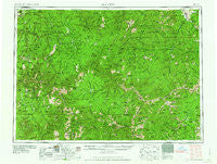
~ Elk City ID topo map, 1:250000 scale, 1 X 2 Degree, Historical, 1960
Elk City, Idaho, USGS topographic map dated 1960.
Includes geographic coordinates (latitude and longitude). This topographic map is suitable for hiking, camping, and exploring, or framing it as a wall map.
Printed on-demand using high resolution imagery, on heavy weight and acid free paper, or alternatively on a variety of synthetic materials.
Topos available on paper, Waterproof, Poly, or Tyvek. Usually shipping rolled, unless combined with other folded maps in one order.
- Product Number: USGS-5437652
- Free digital map download (high-resolution, GeoPDF): Elk City, Idaho (file size: 26 MB)
- Map Size: please refer to the dimensions of the GeoPDF map above
- Weight (paper map): ca. 55 grams
- Map Type: POD USGS Topographic Map
- Map Series: HTMC
- Map Verison: Historical
- Cell ID: 72226
- Scan ID: 239632
- Woodland Tint: Yes
- Visual Version Number: 2
- Aerial Photo Year: 1957
- Field Check Year: 1956
- Datum: Unstated
- Map Projection: Transverse Mercator
- Map published by United States Army Corps of Engineers
- Map published by United States Army
- Map Language: English
- Scanner Resolution: 600 dpi
- Map Cell Name: Elk City
- Grid size: 1 X 2 Degree
- Date on map: 1960
- Map Scale: 1:250000
- Geographical region: Idaho, United States
Neighboring Maps:
All neighboring USGS topo maps are available for sale online at a variety of scales.
Spatial coverage:
Topo map Elk City, Idaho, covers the geographical area associated the following places:
- Gold Point - Jim Moore Place - Newsome - Blackbird - Mud Springs - Elk City - Lightfoot - Shigley Mobile Home Park - Red River Hot Springs - Cobalt - Medicine Hot Springs - Ulysses (historical) - Golden - Burgdorf - Alta - Leesburg - Lawman Ford - Midasville - York - Gibler - Edwardsburg - Cable Car Crossing - Leprouse - Asbestos Point - Fourway Junction - Upper Crossing - Peaks and Pines Park - Turner - Warren - Green - Orogrande - Mackay Bar - Clover (historical) - Dixie - Concord - Calendar - Conner - Big Creek - Cross Trails - Fritser Ford - Old Golden - Fall Creek - Harpster - Shoup
- Map Area ID: AREA4645-116-114
- Northwest corner Lat/Long code: USGSNW46-116
- Northeast corner Lat/Long code: USGSNE46-114
- Southwest corner Lat/Long code: USGSSW45-116
- Southeast corner Lat/Long code: USGSSE45-114
- Northern map edge Latitude: 46
- Southern map edge Latitude: 45
- Western map edge Longitude: -116
- Eastern map edge Longitude: -114


