
~ Driggs ID topo map, 1:250000 scale, 1 X 2 Degree, Historical, 1958
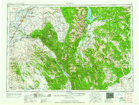
Driggs, Idaho, USGS topographic map dated 1958.
Includes geographic coordinates (latitude and longitude). This topographic map is suitable for hiking, camping, and exploring, or framing it as a wall map.
Printed on-demand using high resolution imagery, on heavy weight and acid free paper, or alternatively on a variety of synthetic materials.
Topos available on paper, Waterproof, Poly, or Tyvek. Usually shipping rolled, unless combined with other folded maps in one order.
- Product Number: USGS-5437628
- Free digital map download (high-resolution, GeoPDF): Driggs, Idaho (file size: 23 MB)
- Map Size: please refer to the dimensions of the GeoPDF map above
- Weight (paper map): ca. 55 grams
- Map Type: POD USGS Topographic Map
- Map Series: HTMC
- Map Verison: Historical
- Cell ID: 68754
- Scan ID: 239620
- Woodland Tint: Yes
- Visual Version Number: 2
- Aerial Photo Year: 1955
- Field Check Year: 1955
- Datum: Unstated
- Map Projection: Transverse Mercator
- Map published by United States Army Corps of Engineers
- Map published by United States Army
- Map Language: English
- Scanner Resolution: 600 dpi
- Map Cell Name: Driggs
- Grid size: 1 X 2 Degree
- Date on map: 1958
- Map Scale: 1:250000
- Geographical region: Idaho, United States
Neighboring Maps:
All neighboring USGS topo maps are available for sale online at a variety of scales.
Spatial coverage:
Topo map Driggs, Idaho, covers the geographical area associated the following places:
- Jensen - Milo - Heise - Chapin - The String - Alpine Junction - Menan - Swan Valley - Rexburg - Alta - Beachs Corner - Clementsville - Two Forks - Moose Wilson Road - Alpine - Thornton - Pyke - Guyaz - Felt - Etna - Colter Bay Village - Moody - Cedron - Hibbard - Teton - Twin Forks - Jackson - Hoback - Caribou City (historical) - Drummond - Moran - Ammon - Gray - Kelly - Wolverine - Teton Village - Lincoln - Irwin - Farnum - Ucon - Labelle - Walker - Lorenzo - Salem - Plano - Keenan City (historical) - Iona - Chester - Parker - Elk - Sunnydell - Edmonds - Judkins - Jolley - Tetonia - Archer - Herman - Mark - Herbert - Lyman - Victor - Annis - Hart - Bone - Grovont - Independence (historical) - France - Wilford - Fox Creek - Rigby - Hinckley - Saint Anthony - Garfield - Clawson - Wilson - Sugar City - Hoback Junction - Lamont - Trailton (historical) - Driggs - Gale - Heman - Woods Crossing - Haden (historical) - Darby - Twin Groves - Poplar - Sam - Egin - Palisades - Parkinson - Dehlin - Jack Pine - Rafter J Ranch - South Park - Rudy - Burton - Bondurant - Newdale - Ririe
- Map Area ID: AREA4443-112-110
- Northwest corner Lat/Long code: USGSNW44-112
- Northeast corner Lat/Long code: USGSNE44-110
- Southwest corner Lat/Long code: USGSSW43-112
- Southeast corner Lat/Long code: USGSSE43-110
- Northern map edge Latitude: 44
- Southern map edge Latitude: 43
- Western map edge Longitude: -112
- Eastern map edge Longitude: -110


