
~ Sturgill Peak ID topo map, 1:62500 scale, 15 X 15 Minute, Historical, 1957, updated 1959
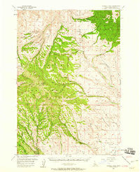
Sturgill Peak, Idaho, USGS topographic map dated 1957.
Includes geographic coordinates (latitude and longitude). This topographic map is suitable for hiking, camping, and exploring, or framing it as a wall map.
Printed on-demand using high resolution imagery, on heavy weight and acid free paper, or alternatively on a variety of synthetic materials.
Topos available on paper, Waterproof, Poly, or Tyvek. Usually shipping rolled, unless combined with other folded maps in one order.
- Product Number: USGS-5437526
- Free digital map download (high-resolution, GeoPDF): Sturgill Peak, Idaho (file size: 10 MB)
- Map Size: please refer to the dimensions of the GeoPDF map above
- Weight (paper map): ca. 55 grams
- Map Type: POD USGS Topographic Map
- Map Series: HTMC
- Map Verison: Historical
- Cell ID: 63050
- Scan ID: 239304
- Imprint Year: 1959
- Woodland Tint: Yes
- Aerial Photo Year: 1953
- Field Check Year: 1957
- Datum: NAD27
- Map Projection: Polyconic
- Map published by United States Geological Survey
- Map Language: English
- Scanner Resolution: 600 dpi
- Map Cell Name: Sturgill Peak
- Grid size: 15 X 15 Minute
- Date on map: 1957
- Map Scale: 1:62500
- Geographical region: Idaho, United States
Neighboring Maps:
All neighboring USGS topo maps are available for sale online at a variety of scales.
Spatial coverage:
Topo map Sturgill Peak, Idaho, covers the geographical area associated the following places:
- Hitt Creek - Cottonwood Spring - Sawlog Glacier - Box Spring - Tribe Spring - Sturgil Peak Lookout - Tamarack Flat - Deadhorse Gulch - East Fork Keithly Creek - Box Gulch - Mill Creek - Tool Cache - Stacy Creek - Kiawanis Campground - Corner Mountain - Mann Creek Guard Station - Bear Creek - Tamarack Creek - East Pine Creek - Benton Saddle - Coffee Spring - Jeffrey Gulch - Cambridge Division - Neil Valley Gulch - Wash Pan Creek - Mulmick Gulch - Porcupine Creek - Spring Creek Campground - Arrowhead Spring - Surdam Gulch - Conner Gulch - Sheep Gulch - Spring Creek - Justrite Campground - Hitt Mountains - Benton Peak - Fairchild Gulch - Advent Gulch - Hitt Peak - Cuddy Meadows Airport - Telephone Saddle - Stickney Glacier - West Cherry Creek - Sturgill Peak - Pine Grass Flat - Camp Creek - Two Tree Gulch - Fourth of July Creek - Lime Spring - Tribe Gulch - Hitt Mountain Ski Area - Paradise Campground - South Pine Creek - Seep Spring - Brownlee Ranger Station - Deer Gulch - Hit Mountain Ski Area - Repeater Station - Coffee Flat - Looney Spring - Sheep Camp Glacier - Bear Saddle - Blue Spring Creek
- Map Area ID: AREA44.7544.5-117-116.75
- Northwest corner Lat/Long code: USGSNW44.75-117
- Northeast corner Lat/Long code: USGSNE44.75-116.75
- Southwest corner Lat/Long code: USGSSW44.5-117
- Southeast corner Lat/Long code: USGSSE44.5-116.75
- Northern map edge Latitude: 44.75
- Southern map edge Latitude: 44.5
- Western map edge Longitude: -117
- Eastern map edge Longitude: -116.75


