
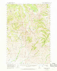
~ Muldoon Canyon ID topo map, 1:62500 scale, 15 X 15 Minute, Historical, 1960, updated 1969
Muldoon Canyon, Idaho, USGS topographic map dated 1960.
Includes geographic coordinates (latitude and longitude). This topographic map is suitable for hiking, camping, and exploring, or framing it as a wall map.
Printed on-demand using high resolution imagery, on heavy weight and acid free paper, or alternatively on a variety of synthetic materials.
Topos available on paper, Waterproof, Poly, or Tyvek. Usually shipping rolled, unless combined with other folded maps in one order.
- Product Number: USGS-5437028
- Free digital map download (high-resolution, GeoPDF): Muldoon Canyon, Idaho (file size: 9 MB)
- Map Size: please refer to the dimensions of the GeoPDF map above
- Weight (paper map): ca. 55 grams
- Map Type: POD USGS Topographic Map
- Map Series: HTMC
- Map Verison: Historical
- Cell ID: 58176
- Scan ID: 239202
- Imprint Year: 1969
- Woodland Tint: Yes
- Aerial Photo Year: 1957
- Field Check Year: 1960
- Datum: NAD27
- Map Projection: Polyconic
- Map published by United States Geological Survey
- Map Language: English
- Scanner Resolution: 600 dpi
- Map Cell Name: Muldoon Canyon
- Grid size: 15 X 15 Minute
- Date on map: 1960
- Map Scale: 1:62500
- Geographical region: Idaho, United States
Neighboring Maps:
All neighboring USGS topo maps are available for sale online at a variety of scales.
Spatial coverage:
Topo map Muldoon Canyon, Idaho, covers the geographical area associated the following places:
- Pioneer Mountain - Grasshopper Creek - Trail Creek - Muldoon Ridge - Mormon Hill - Argosy Creek - Bear Canyon - Little Copper Creek - Timber Creek - Smiley Meadows - Trail Creek - Long Lake - Chicken Creek - Eagle Bird Mine - Muldoon Mine - Garfield Canyon - Copper Creek - Boundary Gulch - Mutual Mine - North Fork Little Copper Creek - Big Canyon - Garfield Mountain - Copper Creek Camp - Idaho Muldoon Mine - Thompson Creek - Bell Rock - Rawson Creek - Green Lake - Lone Pine Creek - Rocky Bar - Rough Lake - Little Thompson Creek - Big Lake - Iron Bog - Blackspar Canyon - Golden Lake - Rough Canyon - Frisco Gulch - Swede Peak - Morman Gulch - Mandolin Spring - Round Lake - Star Hope Campground - Payne Creek - Buck Canyon - White Mountains - Timber Gulch - Brockie Lake - Muldoon - Mutual Gulch - Smiley Mountain - Smiley Creek - Left Fork Iron Bog Creek - Copper Creek Trail - Drummond Mine - Glide Mountain - South Fork Little Copper Creek - Scorpion Mountain - Deadman Creek - Deep Gulch - Star Hope Mine - Kerf Creek - Garfield Forest Service Station - Fox Canyon - Iron Bog Lake - Hurst Canyon - Right Fork Iron Bog Creek - Elk Mountain - Fishpole Lake - Smelter Butte - Star Hope Gulch - Logan Tunnel
- Map Area ID: AREA43.7543.5-114-113.75
- Northwest corner Lat/Long code: USGSNW43.75-114
- Northeast corner Lat/Long code: USGSNE43.75-113.75
- Southwest corner Lat/Long code: USGSSW43.5-114
- Southeast corner Lat/Long code: USGSSE43.5-113.75
- Northern map edge Latitude: 43.75
- Southern map edge Latitude: 43.5
- Western map edge Longitude: -114
- Eastern map edge Longitude: -113.75


