
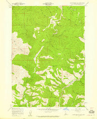
~ Warm Springs Point ID topo map, 1:24000 scale, 7.5 X 7.5 Minute, Historical, 1957, updated 1959
Warm Springs Point, Idaho, USGS topographic map dated 1957.
Includes geographic coordinates (latitude and longitude). This topographic map is suitable for hiking, camping, and exploring, or framing it as a wall map.
Printed on-demand using high resolution imagery, on heavy weight and acid free paper, or alternatively on a variety of synthetic materials.
Topos available on paper, Waterproof, Poly, or Tyvek. Usually shipping rolled, unless combined with other folded maps in one order.
- Product Number: USGS-5436276
- Free digital map download (high-resolution, GeoPDF): Warm Springs Point, Idaho (file size: 15 MB)
- Map Size: please refer to the dimensions of the GeoPDF map above
- Weight (paper map): ca. 55 grams
- Map Type: POD USGS Topographic Map
- Map Series: HTMC
- Map Verison: Historical
- Cell ID: 47486
- Scan ID: 238693
- Imprint Year: 1959
- Woodland Tint: Yes
- Aerial Photo Year: 1948
- Field Check Year: 1957
- Datum: NAD27
- Map Projection: Polyconic
- Map published by United States Forest Service
- Map Language: English
- Scanner Resolution: 600 dpi
- Map Cell Name: Warm Springs Point
- Grid size: 7.5 X 7.5 Minute
- Date on map: 1957
- Map Scale: 1:24000
- Geographical region: Idaho, United States
Neighboring Maps:
All neighboring USGS topo maps are available for sale online at a variety of scales.
Spatial coverage:
Topo map Warm Springs Point, Idaho, covers the geographical area associated the following places:
- Monazite Gulch - Manhattan Creek - Holcomb Guard Station - Valley of the Pines Volunteer Fire Department - Clear Creek - Warm Springs Point - Sugar Creek - Rocky Gulch - Rattlesnake Creek - Wild Goat Creek - Rye Flat - Casner Mountain - Granite Creek - Pine Creek - Gregory Gulch - Deadhorse Gulch - Cold Springs Gulch - Milk Ranch Gulch - Valley of the Pines Volunteer Fire Department - North Fork Sugar Creek - Macks Creek - Big Gulch - Johnny Woods Gulch - Horse Spring Gulch - South Fork Sugar Creek - Hahn Gulch - North Fork Rattlesnake Creek - Greenland Gulch - Lass Gulch - Willow Creek - South Fork Rattlesnake Creek - Wild Horse Creek - New York Gulch - McKinley Gulch
- Map Area ID: AREA43.87543.75-116-115.875
- Northwest corner Lat/Long code: USGSNW43.875-116
- Northeast corner Lat/Long code: USGSNE43.875-115.875
- Southwest corner Lat/Long code: USGSSW43.75-116
- Southeast corner Lat/Long code: USGSSE43.75-115.875
- Northern map edge Latitude: 43.875
- Southern map edge Latitude: 43.75
- Western map edge Longitude: -116
- Eastern map edge Longitude: -115.875


