
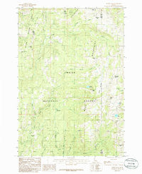
~ Tripod Peak ID topo map, 1:24000 scale, 7.5 X 7.5 Minute, Historical, 1985, updated 1986
Tripod Peak, Idaho, USGS topographic map dated 1985.
Includes geographic coordinates (latitude and longitude). This topographic map is suitable for hiking, camping, and exploring, or framing it as a wall map.
Printed on-demand using high resolution imagery, on heavy weight and acid free paper, or alternatively on a variety of synthetic materials.
Topos available on paper, Waterproof, Poly, or Tyvek. Usually shipping rolled, unless combined with other folded maps in one order.
- Product Number: USGS-5436046
- Free digital map download (high-resolution, GeoPDF): Tripod Peak, Idaho (file size: 13 MB)
- Map Size: please refer to the dimensions of the GeoPDF map above
- Weight (paper map): ca. 55 grams
- Map Type: POD USGS Topographic Map
- Map Series: HTMC
- Map Verison: Historical
- Cell ID: 45710
- Scan ID: 238552
- Imprint Year: 1986
- Woodland Tint: Yes
- Aerial Photo Year: 1980
- Edit Year: 1985
- Field Check Year: 1981
- Datum: NAD27
- Map Projection: Transverse Mercator
- Provisional map: Yes
- Map published by United States Geological Survey
- Map Language: English
- Scanner Resolution: 600 dpi
- Map Cell Name: Tripod Peak
- Grid size: 7.5 X 7.5 Minute
- Date on map: 1985
- Map Scale: 1:24000
- Geographical region: Idaho, United States
Neighboring Maps:
All neighboring USGS topo maps are available for sale online at a variety of scales.
Spatial coverage:
Topo map Tripod Peak, Idaho, covers the geographical area associated the following places:
- Rammage Meadows - Division D Stock Trail - Poison Creek - Bed Ground Creek - FAA Radar Site - Wilson Corrals Trail - Wilson Creek Trail - Buck Canyon Trail - Gabes Peak Trail - Mesa Creek - Woody Creek Trail - West Mountains - Wilson Meadows - Four Bit Summit - Tripod Peak - Tamarack Flat - Gabes Bathtub - Antelope Trail - Tripod Peak Lookout - Pole Creek - Buck Mountain - Four Bit Spur - Wilson Mountain Trail - Potters Pond - Renwyck Trail - Woody Creek - Gabes Peak - Shirts Lake - West Mountain Trail - Granite Peak - Blue Lake - Wilson Peak - Greenfield Flat - Fourbit Spring - Snowbank Mountain - Third Fork Ridge - Hangman Tree
- Map Area ID: AREA44.544.375-116.25-116.125
- Northwest corner Lat/Long code: USGSNW44.5-116.25
- Northeast corner Lat/Long code: USGSNE44.5-116.125
- Southwest corner Lat/Long code: USGSSW44.375-116.25
- Southeast corner Lat/Long code: USGSSE44.375-116.125
- Northern map edge Latitude: 44.5
- Southern map edge Latitude: 44.375
- Western map edge Longitude: -116.25
- Eastern map edge Longitude: -116.125


