
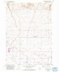
~ Thorn Creek SW ID topo map, 1:24000 scale, 7.5 X 7.5 Minute, Historical, 1957, updated 1992
Thorn Creek SW, Idaho, USGS topographic map dated 1957.
Includes geographic coordinates (latitude and longitude). This topographic map is suitable for hiking, camping, and exploring, or framing it as a wall map.
Printed on-demand using high resolution imagery, on heavy weight and acid free paper, or alternatively on a variety of synthetic materials.
Topos available on paper, Waterproof, Poly, or Tyvek. Usually shipping rolled, unless combined with other folded maps in one order.
- Product Number: USGS-5435924
- Free digital map download (high-resolution, GeoPDF): Thorn Creek SW, Idaho (file size: 9 MB)
- Map Size: please refer to the dimensions of the GeoPDF map above
- Weight (paper map): ca. 55 grams
- Map Type: POD USGS Topographic Map
- Map Series: HTMC
- Map Verison: Historical
- Cell ID: 44935
- Scan ID: 238479
- Imprint Year: 1992
- Aerial Photo Year: 1987
- Edit Year: 1992
- Datum: NAD27
- Map Projection: Transverse Mercator
- Map published by United States Geological Survey
- Map Language: English
- Scanner Resolution: 600 dpi
- Map Cell Name: Thorn Creek SW
- Grid size: 7.5 X 7.5 Minute
- Date on map: 1957
- Map Scale: 1:24000
- Geographical region: Idaho, United States
Neighboring Maps:
All neighboring USGS topo maps are available for sale online at a variety of scales.
Spatial coverage:
Topo map Thorn Creek SW, Idaho, covers the geographical area associated the following places:
- Dog Creek Dam - Lateral 1300 - Rattlesnake Canyon - Dog Creek Reservoir Public Fishing Area - Little City of Rocks - Union Ditch - Lateral 1429 - East Black Canyon Creek - Turkey Lake - North Gooding Main Canal - The Thorns - Randolf Pipe - Turkey Head Butte - Lateral 1590 - Lateral 1660 - Randolf Ditch - Lateral 1566 - Turkey Creek - Dog Creek - Lateral 1590A - Burnt Willow Canyon - Schooler Creek - Robertson Ditch - Dog Creek Reservoir - Lateral 1465A - Union Spillway - Lateral 1310
- Map Area ID: AREA43.12543-114.75-114.625
- Northwest corner Lat/Long code: USGSNW43.125-114.75
- Northeast corner Lat/Long code: USGSNE43.125-114.625
- Southwest corner Lat/Long code: USGSSW43-114.75
- Southeast corner Lat/Long code: USGSSE43-114.625
- Northern map edge Latitude: 43.125
- Southern map edge Latitude: 43
- Western map edge Longitude: -114.75
- Eastern map edge Longitude: -114.625


