
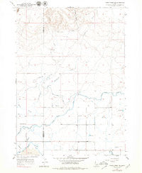
~ Thorn Creek SE ID topo map, 1:24000 scale, 7.5 X 7.5 Minute, Historical, 1957, updated 1979
Thorn Creek SE, Idaho, USGS topographic map dated 1957.
Includes geographic coordinates (latitude and longitude). This topographic map is suitable for hiking, camping, and exploring, or framing it as a wall map.
Printed on-demand using high resolution imagery, on heavy weight and acid free paper, or alternatively on a variety of synthetic materials.
Topos available on paper, Waterproof, Poly, or Tyvek. Usually shipping rolled, unless combined with other folded maps in one order.
- Product Number: USGS-5435922
- Free digital map download (high-resolution, GeoPDF): Thorn Creek SE, Idaho (file size: 8 MB)
- Map Size: please refer to the dimensions of the GeoPDF map above
- Weight (paper map): ca. 55 grams
- Map Type: POD USGS Topographic Map
- Map Series: HTMC
- Map Verison: Historical
- Cell ID: 44934
- Scan ID: 238478
- Imprint Year: 1979
- Photo Inspection Year: 1976
- Aerial Photo Year: 1954
- Field Check Year: 1957
- Datum: NAD27
- Map Projection: Polyconic
- Map published by United States Geological Survey
- Map Language: English
- Scanner Resolution: 600 dpi
- Map Cell Name: Thorn Creek SE
- Grid size: 7.5 X 7.5 Minute
- Date on map: 1957
- Map Scale: 1:24000
- Geographical region: Idaho, United States
Neighboring Maps:
All neighboring USGS topo maps are available for sale online at a variety of scales.
Spatial coverage:
Topo map Thorn Creek SE, Idaho, covers the geographical area associated the following places:
- Portuguese Creek - Preacher Creek - Lateral 916B - 700 Drain - Patterson Dam - Lateral 916 - Timber Gulch - Thorn Creek School - Lateral 916C - Lateral 700B - Thorn Creek - Gooding Reservoir - High Line Canal - Lateral 900 - Lateral 916D - Lateral 916C1B - Lateral 993B - Shoshone City Rural Fire District Station 2 - Thorne Creek Wildlife Habitat Area - Lateral 916E - Lateral 993A - Lateral 916A - Lateral H - Lateral 916S - Lateral 916C4 - Lateral 916C1A - Lateral 916C2 - Lateral 700 - Lateral 916C3 - Lateral 916C1 - Lateral 700A1 - Lateral 992
- Map Area ID: AREA43.12543-114.625-114.5
- Northwest corner Lat/Long code: USGSNW43.125-114.625
- Northeast corner Lat/Long code: USGSNE43.125-114.5
- Southwest corner Lat/Long code: USGSSW43-114.625
- Southeast corner Lat/Long code: USGSSE43-114.5
- Northern map edge Latitude: 43.125
- Southern map edge Latitude: 43
- Western map edge Longitude: -114.625
- Eastern map edge Longitude: -114.5


