
~ Temple Peak ID topo map, 1:24000 scale, 7.5 X 7.5 Minute, Historical, 1979, updated 1985
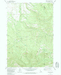
Temple Peak, Idaho, USGS topographic map dated 1979.
Includes geographic coordinates (latitude and longitude). This topographic map is suitable for hiking, camping, and exploring, or framing it as a wall map.
Printed on-demand using high resolution imagery, on heavy weight and acid free paper, or alternatively on a variety of synthetic materials.
Topos available on paper, Waterproof, Poly, or Tyvek. Usually shipping rolled, unless combined with other folded maps in one order.
- Product Number: USGS-5435841
- Free digital map download (high-resolution, GeoPDF): Temple Peak, Idaho (file size: 14 MB)
- Map Size: please refer to the dimensions of the GeoPDF map above
- Weight (paper map): ca. 55 grams
- Map Type: POD USGS Topographic Map
- Map Series: HTMC
- Map Verison: Historical
- Cell ID: 44522
- Scan ID: 238430
- Imprint Year: 1985
- Woodland Tint: Yes
- Aerial Photo Year: 1973
- Edit Year: 1979
- Field Check Year: 1974
- Datum: NAD27
- Map Projection: Transverse Mercator
- Map published by United States Geological Survey
- Map Language: English
- Scanner Resolution: 600 dpi
- Map Cell Name: Temple Peak
- Grid size: 7.5 X 7.5 Minute
- Date on map: 1979
- Map Scale: 1:24000
- Geographical region: Idaho, United States
Neighboring Maps:
All neighboring USGS topo maps are available for sale online at a variety of scales.
Spatial coverage:
Topo map Temple Peak, Idaho, covers the geographical area associated the following places:
- Crystle Lake - Sheep Creek - Castle Lake - South Fork Canyon Creek - Flat Hollow - Twin Peaks - Hilton Creek - Thousand Springs Valley - Beartrap Canyon - Coalmine Canyon - Coalmine Creek - East Farnes Mountain Spring - Bex Spring - West Farnes Mountain - Graham Spring - North Fork Canyon Creek - Carlton Cutoff Trail - Moody Meadow - Lost Spring - Argument Ridge - Farnes Mountain - Prospect Peak - East Farnes Mountain - Little Burns Canyon - Ruby Creek - Marlow Creek - Moody Swamp - Kirkham Hollow
- Map Area ID: AREA43.7543.625-111.5-111.375
- Northwest corner Lat/Long code: USGSNW43.75-111.5
- Northeast corner Lat/Long code: USGSNE43.75-111.375
- Southwest corner Lat/Long code: USGSSW43.625-111.5
- Southeast corner Lat/Long code: USGSSE43.625-111.375
- Northern map edge Latitude: 43.75
- Southern map edge Latitude: 43.625
- Western map edge Longitude: -111.5
- Eastern map edge Longitude: -111.375


