
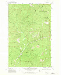
~ Taylor Peak ID topo map, 1:24000 scale, 7.5 X 7.5 Minute, Historical, 1966, updated 1971
Taylor Peak, Idaho, USGS topographic map dated 1966.
Includes geographic coordinates (latitude and longitude). This topographic map is suitable for hiking, camping, and exploring, or framing it as a wall map.
Printed on-demand using high resolution imagery, on heavy weight and acid free paper, or alternatively on a variety of synthetic materials.
Topos available on paper, Waterproof, Poly, or Tyvek. Usually shipping rolled, unless combined with other folded maps in one order.
- Product Number: USGS-5435829
- Free digital map download (high-resolution, GeoPDF): Taylor Peak, Idaho (file size: 14 MB)
- Map Size: please refer to the dimensions of the GeoPDF map above
- Weight (paper map): ca. 55 grams
- Map Type: POD USGS Topographic Map
- Map Series: HTMC
- Map Verison: Historical
- Cell ID: 44389
- Scan ID: 238424
- Imprint Year: 1971
- Woodland Tint: Yes
- Aerial Photo Year: 1965
- Field Check Year: 1966
- Datum: NAD27
- Map Projection: Polyconic
- Map published by United States Geological Survey
- Map Language: English
- Scanner Resolution: 600 dpi
- Map Cell Name: Taylor Peak
- Grid size: 7.5 X 7.5 Minute
- Date on map: 1966
- Map Scale: 1:24000
- Geographical region: Idaho, United States
Neighboring Maps:
All neighboring USGS topo maps are available for sale online at a variety of scales.
Spatial coverage:
Topo map Taylor Peak, Idaho, covers the geographical area associated the following places:
- Taylor Peak - Little Haystack - Chute Creek - Pete Draw - Cabin Creek - Hells Gulch - Hulliman Peak - Bull Creek - Pipe Creek - Offset Gulch - Camp Creek - Haystack Creek - Hulliman Creek - Cabin Peak - North Fork Haystack Creek - Little Haystack Creek - South Fork Falls Creek - Sunday Gulch - Haystack Mountain - Haystack Saddle - Angle Gulch - Windfall Creek - Pine Flat - Berlin Flats - Porcupine Pass - Fir Gulch - Donkey Draw - South Fork Hells Gulch - Cascade Creek - Rampike Creek - Falls Creek - Pine Flat Creek - South Fork Cabin Creek - Ridge Trail - Hawkseye Camp - Rocky Draw - Saddle Creek - Snow Creek - Monday Gulch - Ruth V/SID Mine - Johns Draw - Berlin Gulch - Clinton Creek
- Map Area ID: AREA47.87547.75-116-115.875
- Northwest corner Lat/Long code: USGSNW47.875-116
- Northeast corner Lat/Long code: USGSNE47.875-115.875
- Southwest corner Lat/Long code: USGSSW47.75-116
- Southeast corner Lat/Long code: USGSSE47.75-115.875
- Northern map edge Latitude: 47.875
- Southern map edge Latitude: 47.75
- Western map edge Longitude: -116
- Eastern map edge Longitude: -115.875


