
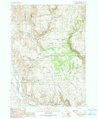
~ Stonehouse Creek ID topo map, 1:24000 scale, 7.5 X 7.5 Minute, Historical, 1990, updated 1991
Stonehouse Creek, Idaho, USGS topographic map dated 1990.
Includes geographic coordinates (latitude and longitude). This topographic map is suitable for hiking, camping, and exploring, or framing it as a wall map.
Printed on-demand using high resolution imagery, on heavy weight and acid free paper, or alternatively on a variety of synthetic materials.
Topos available on paper, Waterproof, Poly, or Tyvek. Usually shipping rolled, unless combined with other folded maps in one order.
- Product Number: USGS-5435675
- Free digital map download (high-resolution, GeoPDF): Stonehouse Creek, Idaho (file size: 15 MB)
- Map Size: please refer to the dimensions of the GeoPDF map above
- Weight (paper map): ca. 55 grams
- Map Type: POD USGS Topographic Map
- Map Series: HTMC
- Map Verison: Historical
- Cell ID: 43318
- Scan ID: 238336
- Imprint Year: 1991
- Woodland Tint: Yes
- Aerial Photo Year: 1984
- Edit Year: 1990
- Field Check Year: 1987
- Datum: NAD27
- Map Projection: Transverse Mercator
- Provisional map: Yes
- Map published by United States Geological Survey
- Map Language: English
- Scanner Resolution: 600 dpi
- Map Cell Name: Stonehouse Creek
- Grid size: 7.5 X 7.5 Minute
- Date on map: 1990
- Map Scale: 1:24000
- Geographical region: Idaho, United States
Neighboring Maps:
All neighboring USGS topo maps are available for sale online at a variety of scales.
Spatial coverage:
Topo map Stonehouse Creek, Idaho, covers the geographical area associated the following places:
- Dead Horse Spring - Crossroads Spring - East Fork Trout Creek - Summit Spring Number One - South Spring - West Fork Goose Creek - Connors Canyon - Williams Creek - Summit Spring Number Two - Duck Creek - Stonehouse Creek - East Fork Goose Creek - Thorne Spring - Ibex Spring - Split Rock - Mud Springs - Connors Spring - East Goose Creek Pond - Goose Creek Spring - Mud Springs Pond - Five Spring - Pack Hook Spring - Goose Creek - Split Rock Canyon - Pleasant Valley Cemetery - West Fork Trout Creek - Noble Basin - Sheep Spring - Lone Tree Creek - Sams Pond - Big Springs - Cottonwood Creek - Wood Canyon - Cottonwood Trail Pond
- Map Area ID: AREA4342.875-117-116.875
- Northwest corner Lat/Long code: USGSNW43-117
- Northeast corner Lat/Long code: USGSNE43-116.875
- Southwest corner Lat/Long code: USGSSW42.875-117
- Southeast corner Lat/Long code: USGSSE42.875-116.875
- Northern map edge Latitude: 43
- Southern map edge Latitude: 42.875
- Western map edge Longitude: -117
- Eastern map edge Longitude: -116.875


