
~ Sheep Mountain ID topo map, 1:24000 scale, 7.5 X 7.5 Minute, Historical, 1994, updated 1997
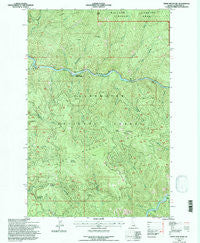
Sheep Mountain, Idaho, USGS topographic map dated 1994.
Includes geographic coordinates (latitude and longitude). This topographic map is suitable for hiking, camping, and exploring, or framing it as a wall map.
Printed on-demand using high resolution imagery, on heavy weight and acid free paper, or alternatively on a variety of synthetic materials.
Topos available on paper, Waterproof, Poly, or Tyvek. Usually shipping rolled, unless combined with other folded maps in one order.
- Product Number: USGS-5435281
- Free digital map download (high-resolution, GeoPDF): Sheep Mountain, Idaho (file size: 20 MB)
- Map Size: please refer to the dimensions of the GeoPDF map above
- Weight (paper map): ca. 55 grams
- Map Type: POD USGS Topographic Map
- Map Series: HTMC
- Map Verison: Historical
- Cell ID: 40885
- Scan ID: 238095
- Imprint Year: 1997
- Woodland Tint: Yes
- Aerial Photo Year: 1990
- Edit Year: 1994
- Datum: NAD27
- Map Projection: Lambert Conformal Conic
- Map published by United States Forest Service
- Map Language: English
- Scanner Resolution: 600 dpi
- Map Cell Name: Sheep Mountain
- Grid size: 7.5 X 7.5 Minute
- Date on map: 1994
- Map Scale: 1:24000
- Geographical region: Idaho, United States
Neighboring Maps:
All neighboring USGS topo maps are available for sale online at a variety of scales.
Spatial coverage:
Topo map Sheep Mountain, Idaho, covers the geographical area associated the following places:
- Sheep Mountain - Sheep Creek - Governor Creek - Eagle Creek - Upper Twin Creek - Owl Creek - Lost Pete Creek - Grasshopper Creek - Canyon Work Center - Raft Creek - Preceptor Point - West Sister - Eagle Point - Len Creek - June Creek - Fern Creek - Fish Creek - Beaver Creek - Dog Creek - Fern Ridge - Lower Twin Creek - Canyon Ranger Station - Star Creek - Broom Creek - Swanson Saddle - Flat Creek - Ermine Creek - Sneak Creek - Leuty Creek - Aquarius Campground - Sheep Mountain Range - Sheep Mountain Saddle
- Map Area ID: AREA46.87546.75-115.625-115.5
- Northwest corner Lat/Long code: USGSNW46.875-115.625
- Northeast corner Lat/Long code: USGSNE46.875-115.5
- Southwest corner Lat/Long code: USGSSW46.75-115.625
- Southeast corner Lat/Long code: USGSSE46.75-115.5
- Northern map edge Latitude: 46.875
- Southern map edge Latitude: 46.75
- Western map edge Longitude: -115.625
- Eastern map edge Longitude: -115.5


