
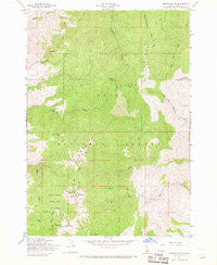
~ Shafer Butte ID topo map, 1:24000 scale, 7.5 X 7.5 Minute, Historical, 1957, updated 1969
Shafer Butte, Idaho, USGS topographic map dated 1957.
Includes geographic coordinates (latitude and longitude). This topographic map is suitable for hiking, camping, and exploring, or framing it as a wall map.
Printed on-demand using high resolution imagery, on heavy weight and acid free paper, or alternatively on a variety of synthetic materials.
Topos available on paper, Waterproof, Poly, or Tyvek. Usually shipping rolled, unless combined with other folded maps in one order.
- Product Number: USGS-5435251
- Free digital map download (high-resolution, GeoPDF): Shafer Butte, Idaho (file size: 14 MB)
- Map Size: please refer to the dimensions of the GeoPDF map above
- Weight (paper map): ca. 55 grams
- Map Type: POD USGS Topographic Map
- Map Series: HTMC
- Map Verison: Historical
- Cell ID: 40732
- Scan ID: 238079
- Imprint Year: 1969
- Woodland Tint: Yes
- Aerial Photo Year: 1939
- Field Check Year: 1957
- Datum: NAD27
- Map Projection: Polyconic
- Map published by United States Forest Service
- Map Language: English
- Scanner Resolution: 600 dpi
- Map Cell Name: Shafer Butte
- Grid size: 7.5 X 7.5 Minute
- Date on map: 1957
- Map Scale: 1:24000
- Geographical region: Idaho, United States
Neighboring Maps:
All neighboring USGS topo maps are available for sale online at a variety of scales.
Spatial coverage:
Topo map Shafer Butte, Idaho, covers the geographical area associated the following places:
- North Fork Macks Creek - KJHY-FM (Emmett) - KFXD-FM (Nampa) - Castle Rock - KLCI-FM (Nampa) - Bongus Basin Winter Sports Area - Shafer Butte Picnic Area - KTVB-TV (Boise) - KBSU-FM (Boise) - Doe Point - North Fork Pine Creek - KCIX-FM (Garden City) - KAID-TV (Boise) - Boise Ridge - KTRV-TV (Nampa) - KZMG-FM (New Plymouth) - KBXL-FM (Caldwell) - KBCI-TV (Boise) - KHEZ-FM (Caldwell) - Bogus Basin State Park - KQFC-FM (Boise) - KIVI-TV (Nampa) - Mores Mountain - KZMG-FM (Boise) - South Fork Pine Creek - Deer Point - KJOT-FM (Boise) - Tartar Gulch - KTSY-FM (Caldwell) - Coyote Rock - KLTB-FM (Boise) - Sugarloaf Rock - Shafer Butte - Bogus Basin
- Map Area ID: AREA43.87543.75-116.125-116
- Northwest corner Lat/Long code: USGSNW43.875-116.125
- Northeast corner Lat/Long code: USGSNE43.875-116
- Southwest corner Lat/Long code: USGSSW43.75-116.125
- Southeast corner Lat/Long code: USGSSE43.75-116
- Northern map edge Latitude: 43.875
- Southern map edge Latitude: 43.75
- Western map edge Longitude: -116.125
- Eastern map edge Longitude: -116


