
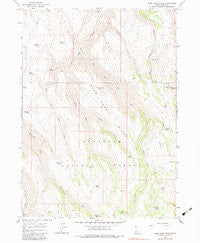
~ Rams Horn Ridge ID topo map, 1:24000 scale, 7.5 X 7.5 Minute, Historical, 1965, updated 1983
Rams Horn Ridge, Idaho, USGS topographic map dated 1965.
Includes geographic coordinates (latitude and longitude). This topographic map is suitable for hiking, camping, and exploring, or framing it as a wall map.
Printed on-demand using high resolution imagery, on heavy weight and acid free paper, or alternatively on a variety of synthetic materials.
Topos available on paper, Waterproof, Poly, or Tyvek. Usually shipping rolled, unless combined with other folded maps in one order.
- Product Number: USGS-5434783
- Free digital map download (high-resolution, GeoPDF): Rams Horn Ridge, Idaho (file size: 11 MB)
- Map Size: please refer to the dimensions of the GeoPDF map above
- Weight (paper map): ca. 55 grams
- Map Type: POD USGS Topographic Map
- Map Series: HTMC
- Map Verison: Historical
- Cell ID: 36983
- Scan ID: 237808
- Imprint Year: 1983
- Woodland Tint: Yes
- Photo Inspection Year: 1976
- Aerial Photo Year: 1961
- Field Check Year: 1965
- Datum: NAD27
- Map Projection: Polyconic
- Map published by United States Geological Survey
- Map Language: English
- Scanner Resolution: 600 dpi
- Map Cell Name: Rams Horn Ridge
- Grid size: 7.5 X 7.5 Minute
- Date on map: 1965
- Map Scale: 1:24000
- Geographical region: Idaho, United States
Neighboring Maps:
All neighboring USGS topo maps are available for sale online at a variety of scales.
Spatial coverage:
Topo map Rams Horn Ridge, Idaho, covers the geographical area associated the following places:
- East Fork Dry Creek - Coal Pit Butte - Fuller Reservoir - Bowers Spring - Rams Horn Ridge - Keith Reservoir - Dry Fork Spring - Dry Fork - Middle Fork Dry Creek - Deadeye Reservoir - Coyote Creek - Jeffs Spring - Wahlstrom Hollow - Lost Hat Spring - Mikes Cabin - Medley Creek - Horse Hollow - Oliver Spring - Third Fork Rock Creek - Antelope Spring - Cold Spring - Basin Patch Spring - East Line Spring - Coal Pit Creek - Porcupine Spring - West Fork Dry Creek - Mud Spring - Indian Spring - Franks Spring - Cold Spring - Stump Hollow - Coyote Spring
- Map Area ID: AREA42.37542.25-114.25-114.125
- Northwest corner Lat/Long code: USGSNW42.375-114.25
- Northeast corner Lat/Long code: USGSNE42.375-114.125
- Southwest corner Lat/Long code: USGSSW42.25-114.25
- Southeast corner Lat/Long code: USGSSE42.25-114.125
- Northern map edge Latitude: 42.375
- Southern map edge Latitude: 42.25
- Western map edge Longitude: -114.25
- Eastern map edge Longitude: -114.125


