
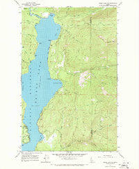
~ Priest Lake NE ID topo map, 1:24000 scale, 7.5 X 7.5 Minute, Historical, 1967, updated 1971
Priest Lake NE, Idaho, USGS topographic map dated 1967.
Includes geographic coordinates (latitude and longitude). This topographic map is suitable for hiking, camping, and exploring, or framing it as a wall map.
Printed on-demand using high resolution imagery, on heavy weight and acid free paper, or alternatively on a variety of synthetic materials.
Topos available on paper, Waterproof, Poly, or Tyvek. Usually shipping rolled, unless combined with other folded maps in one order.
- Product Number: USGS-5434689
- Free digital map download (high-resolution, GeoPDF): Priest Lake NE, Idaho (file size: 14 MB)
- Map Size: please refer to the dimensions of the GeoPDF map above
- Weight (paper map): ca. 55 grams
- Map Type: POD USGS Topographic Map
- Map Series: HTMC
- Map Verison: Historical
- Cell ID: 71304
- Scan ID: 237753
- Imprint Year: 1971
- Woodland Tint: Yes
- Aerial Photo Year: 1967
- Field Check Year: 1967
- Datum: NAD27
- Map Projection: Polyconic
- Map published by United States Geological Survey
- Map Language: English
- Scanner Resolution: 600 dpi
- Map Cell Name: Priest Lake NE
- Grid size: 7.5 X 7.5 Minute
- Date on map: 1967
- Map Scale: 1:24000
- Geographical region: Idaho, United States
Neighboring Maps:
All neighboring USGS topo maps are available for sale online at a variety of scales.
Spatial coverage:
Topo map Priest Lake NE, Idaho, covers the geographical area associated the following places:
- Camp Codge - Squaw Bay - Bear Creek Bay - South Fork Indian Creek - The Thorofare - Lion Creek - Twin Islands - Teachers Bay - Two Mouth Guard Station - Caribou Creek - Priest Lake State Park Lionhead Unit - Bottle Bay - Huckleberry Bay - Beaver Creek Recreation Site - Mosquito Bay - Granite Creek - South Fork Lion Creek - Canoe Point - Bottle Creek - Tepee Creek Research Natural Area - North Fork Indian Creek - Tripod Point - Tango Creek - Klootch Mountain - Distillery Bay - Lucky Creek - Squaw Creek - North Fork Squaw Creek - North of the Narrows Fire District - Two Mouth Creek - Lionhead Recretaion Site - Beaver Creek - Goose Creek - Tepee Creek - Tule Bay - Bear Creek
- Map Area ID: AREA48.7548.625-116.875-116.75
- Northwest corner Lat/Long code: USGSNW48.75-116.875
- Northeast corner Lat/Long code: USGSNE48.75-116.75
- Southwest corner Lat/Long code: USGSSW48.625-116.875
- Southeast corner Lat/Long code: USGSSE48.625-116.75
- Northern map edge Latitude: 48.75
- Southern map edge Latitude: 48.625
- Western map edge Longitude: -116.875
- Eastern map edge Longitude: -116.75


