
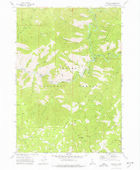
~ Pine Flat ID topo map, 1:24000 scale, 7.5 X 7.5 Minute, Historical, 1972, updated 1977
Pine Flat, Idaho, USGS topographic map dated 1972.
Includes geographic coordinates (latitude and longitude). This topographic map is suitable for hiking, camping, and exploring, or framing it as a wall map.
Printed on-demand using high resolution imagery, on heavy weight and acid free paper, or alternatively on a variety of synthetic materials.
Topos available on paper, Waterproof, Poly, or Tyvek. Usually shipping rolled, unless combined with other folded maps in one order.
- Product Number: USGS-5434495
- Free digital map download (high-resolution, GeoPDF): Pine Flat, Idaho (file size: 14 MB)
- Map Size: please refer to the dimensions of the GeoPDF map above
- Weight (paper map): ca. 55 grams
- Map Type: POD USGS Topographic Map
- Map Series: HTMC
- Map Verison: Historical
- Cell ID: 35245
- Scan ID: 237635
- Imprint Year: 1977
- Woodland Tint: Yes
- Aerial Photo Year: 1971
- Field Check Year: 1972
- Datum: NAD27
- Map Projection: Transverse Mercator
- Map published by United States Geological Survey
- Map Language: English
- Scanner Resolution: 600 dpi
- Map Cell Name: Pine Flat
- Grid size: 7.5 X 7.5 Minute
- Date on map: 1972
- Map Scale: 1:24000
- Geographical region: Idaho, United States
Neighboring Maps:
All neighboring USGS topo maps are available for sale online at a variety of scales.
Spatial coverage:
Topo map Pine Flat, Idaho, covers the geographical area associated the following places:
- Pine Flat - Deadwood Jim Creek - Cooley Creek - Assay Creek - Road Fork Creek - Windy Point - Pine Flats Campground - Big Falls - Rattlesnake Gulch - Mammoth Mine - Slaughterhouse Creek - Stevens Creek - Hole in the Wall Creek - Timber Point - Monumental Creek - Deadwood Campground - Oxbow Bend - Golden Chariot Mine - Fir Creek - Slim Creek - Pine Flat Creek - Burns Ridge - Coulter Summit - Pine Flat Hot Springs - Birch Creek - Deadwood River - Coulter Gulch - Little Hole in the Wall Creek - Pine Flat Access Area - Rock Creek - Long Gulch - Birch Flat - Pidgeon Flat - Golden Cycle Mine - Sloper Mine
- Map Area ID: AREA44.12544-115.75-115.625
- Northwest corner Lat/Long code: USGSNW44.125-115.75
- Northeast corner Lat/Long code: USGSNE44.125-115.625
- Southwest corner Lat/Long code: USGSSW44-115.75
- Southeast corner Lat/Long code: USGSSE44-115.625
- Northern map edge Latitude: 44.125
- Southern map edge Latitude: 44
- Western map edge Longitude: -115.75
- Eastern map edge Longitude: -115.625


