
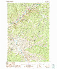
~ Pine Creek Rapids ID topo map, 1:24000 scale, 7.5 X 7.5 Minute, Historical, 1991, updated 1991
Pine Creek Rapids, Idaho, USGS topographic map dated 1991.
Includes geographic coordinates (latitude and longitude). This topographic map is suitable for hiking, camping, and exploring, or framing it as a wall map.
Printed on-demand using high resolution imagery, on heavy weight and acid free paper, or alternatively on a variety of synthetic materials.
Topos available on paper, Waterproof, Poly, or Tyvek. Usually shipping rolled, unless combined with other folded maps in one order.
- Product Number: USGS-5434491
- Free digital map download (high-resolution, GeoPDF): Pine Creek Rapids, Idaho (file size: 19 MB)
- Map Size: please refer to the dimensions of the GeoPDF map above
- Weight (paper map): ca. 55 grams
- Map Type: POD USGS Topographic Map
- Map Series: HTMC
- Map Verison: Historical
- Cell ID: 35240
- Scan ID: 237633
- Imprint Year: 1991
- Woodland Tint: Yes
- Aerial Photo Year: 1985
- Edit Year: 1991
- Field Check Year: 1988
- Datum: NAD27
- Map Projection: Transverse Mercator
- Provisional map: Yes
- Map published by United States Geological Survey
- Map Language: English
- Scanner Resolution: 600 dpi
- Map Cell Name: Pine Creek Rapids
- Grid size: 7.5 X 7.5 Minute
- Date on map: 1991
- Map Scale: 1:24000
- Geographical region: Idaho, United States
Neighboring Maps:
All neighboring USGS topo maps are available for sale online at a variety of scales.
Spatial coverage:
Topo map Pine Creek Rapids, Idaho, covers the geographical area associated the following places:
- Smith Gulch - Eagles Nest - Grunter Mine - Wire Gulch - Copper Mountain Trail - Hot Springs Lookout - Little Sheepeater Creek - Hot Springs Trail (historical) - Sawlog Gulch - Big Sheepeater Creek - Pine Creek - Mayflower Mine - Sawmill Gulch - Trail Creek - Beaver Creek - Copper Mountain - Rood Gulch - Mayflower Gulch - Wagon Road Gulch - Copper Canyon - Rood Ranch (historical) - Birch Creek - Copper King Mine - Clipper Bullion Mine - Pine Creek Ranch (historical) - Kentuck Mine - Dutch Oven Rapids - Big Lead Mine - Hot Springs Creek - Dry Wash Gulch - Clear Creek - Dutch Oven Creek - German Gulch - Reservoir Gulch - Dry Gulch - Clear Creek Recreation Site - Pine Creek Rapids - Cohen Gulch - Gold Hill Mine - Halfway Gulch - Hot Springs
- Map Area ID: AREA45.37545.25-114.375-114.25
- Northwest corner Lat/Long code: USGSNW45.375-114.375
- Northeast corner Lat/Long code: USGSNE45.375-114.25
- Southwest corner Lat/Long code: USGSSW45.25-114.375
- Southeast corner Lat/Long code: USGSSE45.25-114.25
- Northern map edge Latitude: 45.375
- Southern map edge Latitude: 45.25
- Western map edge Longitude: -114.375
- Eastern map edge Longitude: -114.25


