
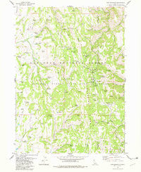
~ Pike Mountain ID topo map, 1:24000 scale, 7.5 X 7.5 Minute, Historical, 1978, updated 1982
Pike Mountain, Idaho, USGS topographic map dated 1978.
Includes geographic coordinates (latitude and longitude). This topographic map is suitable for hiking, camping, and exploring, or framing it as a wall map.
Printed on-demand using high resolution imagery, on heavy weight and acid free paper, or alternatively on a variety of synthetic materials.
Topos available on paper, Waterproof, Poly, or Tyvek. Usually shipping rolled, unless combined with other folded maps in one order.
- Product Number: USGS-5434461
- Free digital map download (high-resolution, GeoPDF): Pike Mountain, Idaho (file size: 12 MB)
- Map Size: please refer to the dimensions of the GeoPDF map above
- Weight (paper map): ca. 55 grams
- Map Type: POD USGS Topographic Map
- Map Series: HTMC
- Map Verison: Historical
- Cell ID: 35137
- Scan ID: 237614
- Imprint Year: 1982
- Woodland Tint: Yes
- Aerial Photo Year: 1972
- Edit Year: 1978
- Field Check Year: 1974
- Datum: NAD27
- Map Projection: Transverse Mercator
- Map published by United States Geological Survey
- Map Language: English
- Scanner Resolution: 600 dpi
- Map Cell Name: Pike Mountain
- Grid size: 7.5 X 7.5 Minute
- Date on map: 1978
- Map Scale: 1:24000
- Geographical region: Idaho, United States
Neighboring Maps:
All neighboring USGS topo maps are available for sale online at a variety of scales.
Spatial coverage:
Topo map Pike Mountain, Idaho, covers the geographical area associated the following places:
- Trail Canyon Spring - Diamond Creek - Kum Ba Yah Camp - Bear Hollow - Rickenbacker Spring - Porcupine Spring - Lower Penstemon Campground - Elk Basin - Shoshone Forest Service Station - Eagle Spring - F S Spring Creek - Lamb Spring - Bald Hill Spring Number 1 - Wagon Spring - F S Spring - Black Mountain - Summit Spring - Electric Spring - Fawn Spring - Bud Spring - Deer Spring - Elk Butte Spring - Elk Corral Spring - Hinton Spring - Camp Spring - Cliff Spring - Pike Mountain Spring - Buzzard Spring - Upper Penstemon Campground - Joes Spring - Bald Hill - Chad Spring - Deadline Corral - Middle Fork Shoshone Creek - Thoroughbred Flat - McConnell Spring - Ross Falls - Lost Spring - Elk Spring - Little Fork Spring - Tawakani Camp - Buckskin Ridge - Blue Mud Spring - North Fork Shoshone Creek - South Fork Narrows Creek - Kirkman Campground - Mountain View Creek - Wagonwheel Spring - Thoroughbred Spring - Frahm Spring - Pedro Spring - Elk Butte - Bald Hill Spring Number 2 - Eagle Spring Creek - Mountain View Spring - Toolbox Creek - Ashbury Spring - Pike Mountain - Magic Mountain Ski Area - Pettit Campground - Narrows Creek - North Fork Narrows Creek - Shoshone Spring - Stove Gulch Spring - Rock Creek Guard Station - Lava Spring - Middle Fork Third Fork Rock Creek - Trail Canyon - Blind Creek - South Fork Shoshone Creek - Pond Spring - Porcupine Spring Picnic Area - Jack Creek - Sanitary Spring - Halfway Spring - Yellow Jacket Spring - Orin Spring - Shoshone Cabin - Electric Spring Creek - Mountain View Peak - Tool Point - South Willow Spring
- Map Area ID: AREA42.2542.125-114.375-114.25
- Northwest corner Lat/Long code: USGSNW42.25-114.375
- Northeast corner Lat/Long code: USGSNE42.25-114.25
- Southwest corner Lat/Long code: USGSSW42.125-114.375
- Southeast corner Lat/Long code: USGSSE42.125-114.25
- Northern map edge Latitude: 42.25
- Southern map edge Latitude: 42.125
- Western map edge Longitude: -114.375
- Eastern map edge Longitude: -114.25


