
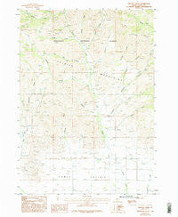
~ Phillips Creek ID topo map, 1:24000 scale, 7.5 X 7.5 Minute, Historical, 1986, updated 1996
Phillips Creek, Idaho, USGS topographic map dated 1986.
Includes geographic coordinates (latitude and longitude). This topographic map is suitable for hiking, camping, and exploring, or framing it as a wall map.
Printed on-demand using high resolution imagery, on heavy weight and acid free paper, or alternatively on a variety of synthetic materials.
Topos available on paper, Waterproof, Poly, or Tyvek. Usually shipping rolled, unless combined with other folded maps in one order.
- Product Number: USGS-5434447
- Free digital map download (high-resolution, GeoPDF): Phillips Creek, Idaho (file size: 12 MB)
- Map Size: please refer to the dimensions of the GeoPDF map above
- Weight (paper map): ca. 55 grams
- Map Type: POD USGS Topographic Map
- Map Series: HTMC
- Map Verison: Historical
- Cell ID: 34972
- Scan ID: 237607
- Imprint Year: 1996
- Woodland Tint: Yes
- Aerial Photo Year: 1981
- Edit Year: 1995
- Field Check Year: 1981
- Datum: NAD27
- Map Projection: Transverse Mercator
- Provisional map: Yes
- Map published by United States Geological Survey
- Map Language: English
- Scanner Resolution: 600 dpi
- Map Cell Name: Phillips Creek
- Grid size: 7.5 X 7.5 Minute
- Date on map: 1986
- Map Scale: 1:24000
- Geographical region: Idaho, United States
Neighboring Maps:
All neighboring USGS topo maps are available for sale online at a variety of scales.
Spatial coverage:
Topo map Phillips Creek, Idaho, covers the geographical area associated the following places:
- Wells Summit - Free Gold Creek - McCan Gulch - Soldier Forest Camp - Mountain View Cemetery - Pioneer Campground - Sampson Creek - Soldier Mountain Ski Area - Richard Allen Mine - Camas County - Elk Ridge - Williams Creek - Owens Creek - North Fork Soldier Creek - Edwards Gulch - Bridge Creek - Phillips Creek - Reedy Creek - South Fork Soldier Creek - Lawrence Creek - Wardrop Creek - Brush Canyon
- Map Area ID: AREA43.543.375-114.875-114.75
- Northwest corner Lat/Long code: USGSNW43.5-114.875
- Northeast corner Lat/Long code: USGSNE43.5-114.75
- Southwest corner Lat/Long code: USGSSW43.375-114.875
- Southeast corner Lat/Long code: USGSSE43.375-114.75
- Northern map edge Latitude: 43.5
- Southern map edge Latitude: 43.375
- Western map edge Longitude: -114.875
- Eastern map edge Longitude: -114.75


