
~ Peck Mountain ID topo map, 1:24000 scale, 7.5 X 7.5 Minute, Historical, 2004, updated 2007
Peck Mountain, Idaho, USGS topographic map dated 2004.
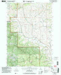
Includes geographic coordinates (latitude and longitude). This topographic map is suitable for hiking, camping, and exploring, or framing it as a wall map.
Printed on-demand using high resolution imagery, on heavy weight and acid free paper, or alternatively on a variety of synthetic materials.
Topos available on paper, Waterproof, Poly, or Tyvek. Usually shipping rolled, unless combined with other folded maps in one order.
- Product Number: USGS-5434413
- Free digital map download (high-resolution, GeoPDF): Peck Mountain, Idaho (file size: 15 MB)
- Map Size: please refer to the dimensions of the GeoPDF map above
- Weight (paper map): ca. 55 grams
- Map Type: POD USGS Topographic Map
- Map Series: HTMC
- Map Verison: Historical
- Cell ID: 34589
- Scan ID: 237588
- Imprint Year: 2007
- Woodland Tint: Yes
- Aerial Photo Year: 1998
- Edit Year: 2004
- Datum: NAD83
- Map Projection: Universal Transverse Mercator
- Map published by United States Geological Survey
- Map published by United States Forest Service
- Map Language: English
- Scanner Resolution: 600 dpi
- Map Cell Name: Peck Mountain
- Grid size: 7.5 X 7.5 Minute
- Date on map: 2004
- Map Scale: 1:24000
- Geographical region: Idaho, United States
Neighboring Maps:
All neighboring USGS topo maps are available for sale online at a variety of scales.
Spatial coverage:
Topo map Peck Mountain, Idaho, covers the geographical area associated the following places:
- Skunk Cabbage Flat - Flying Y Ranch Airport - Long Gulch Ridge - North Hornet Creek - Peck Mountain Spring - Council Division - Ridge School (historical) - Sonner Creek - Badger Gulch - Grouse Spring - Dry Creek - Left Fork North Hornet Creek - Traction Gulch - Horse Flat - Stony Point - Upper Dale School - Pleasant Ridge - Timber Gulch - Pole Creek - Robison Gulch - Horse Spring - Lakey Creek - Ellsworth-Middle Dam - Long Gulch - Peck Mountain - Fir Creek - Hanson Creek - Mill Creek - Pearl Creek
- Map Area ID: AREA44.87544.75-116.625-116.5
- Northwest corner Lat/Long code: USGSNW44.875-116.625
- Northeast corner Lat/Long code: USGSNE44.875-116.5
- Southwest corner Lat/Long code: USGSSW44.75-116.625
- Southeast corner Lat/Long code: USGSSE44.75-116.5
- Northern map edge Latitude: 44.875
- Southern map edge Latitude: 44.75
- Western map edge Longitude: -116.625
- Eastern map edge Longitude: -116.5


