
~ Mt Cramer ID topo map, 1:24000 scale, 7.5 X 7.5 Minute, Historical, 1963, updated 1964
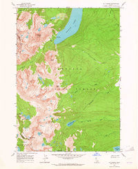
Mt Cramer, Idaho, USGS topographic map dated 1963.
Includes geographic coordinates (latitude and longitude). This topographic map is suitable for hiking, camping, and exploring, or framing it as a wall map.
Printed on-demand using high resolution imagery, on heavy weight and acid free paper, or alternatively on a variety of synthetic materials.
Topos available on paper, Waterproof, Poly, or Tyvek. Usually shipping rolled, unless combined with other folded maps in one order.
- Product Number: USGS-5433954
- Free digital map download (high-resolution, GeoPDF): Mt Cramer, Idaho (file size: 14 MB)
- Map Size: please refer to the dimensions of the GeoPDF map above
- Weight (paper map): ca. 55 grams
- Map Type: POD USGS Topographic Map
- Map Series: HTMC
- Map Verison: Historical
- Cell ID: 30545
- Scan ID: 237325
- Imprint Year: 1964
- Woodland Tint: Yes
- Visual Version Number: 1
- Aerial Photo Year: 1957
- Field Check Year: 1963
- Datum: NAD27
- Map Projection: Polyconic
- Map published by United States Geological Survey
- Map Language: English
- Scanner Resolution: 600 dpi
- Map Cell Name: Mount Cramer
- Grid size: 7.5 X 7.5 Minute
- Date on map: 1963
- Map Scale: 1:24000
- Geographical region: Idaho, United States
Neighboring Maps:
All neighboring USGS topo maps are available for sale online at a variety of scales.
Spatial coverage:
Topo map Mt Cramer, Idaho, covers the geographical area associated the following places:
- Yellow Belly Lake - Bull Moose Trail - Decker Peak - Heyburn Mountain - Upper Cramer Lake - The Arrowhead - Hell Roaring Lake - Sevy Peak - Profile Lake - Lower Cramer Lake - Redfish Inlet Transfer Camp - Finger of Fate - Bench Lakes - Braxon Peak - Middle Cramer Lake - Grand Mogul - Redfish Lake - Hidden Lake - Saddleback Lakes - Mount Cramer - The Temple - Elk Meadow - Lily Lake
- Map Area ID: AREA44.12544-115-114.875
- Northwest corner Lat/Long code: USGSNW44.125-115
- Northeast corner Lat/Long code: USGSNE44.125-114.875
- Southwest corner Lat/Long code: USGSSW44-115
- Southeast corner Lat/Long code: USGSSE44-114.875
- Northern map edge Latitude: 44.125
- Southern map edge Latitude: 44
- Western map edge Longitude: -115
- Eastern map edge Longitude: -114.875


