
~ Moscow Mtn ID topo map, 1:24000 scale, 7.5 X 7.5 Minute, Historical, 1960, updated 1961
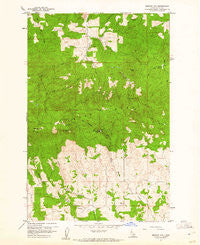
Moscow Mtn, Idaho, USGS topographic map dated 1960.
Includes geographic coordinates (latitude and longitude). This topographic map is suitable for hiking, camping, and exploring, or framing it as a wall map.
Printed on-demand using high resolution imagery, on heavy weight and acid free paper, or alternatively on a variety of synthetic materials.
Topos available on paper, Waterproof, Poly, or Tyvek. Usually shipping rolled, unless combined with other folded maps in one order.
- Product Number: USGS-5433866
- Free digital map download (high-resolution, GeoPDF): Moscow Mtn, Idaho (file size: 16 MB)
- Map Size: please refer to the dimensions of the GeoPDF map above
- Weight (paper map): ca. 55 grams
- Map Type: POD USGS Topographic Map
- Map Series: HTMC
- Map Verison: Historical
- Cell ID: 30351
- Scan ID: 237264
- Imprint Year: 1961
- Woodland Tint: Yes
- Aerial Photo Year: 1957
- Field Check Year: 1960
- Datum: NAD27
- Map Projection: Polyconic
- Map published by United States Geological Survey
- Map Language: English
- Scanner Resolution: 600 dpi
- Map Cell Name: Moscow Mountain
- Grid size: 7.5 X 7.5 Minute
- Date on map: 1960
- Map Scale: 1:24000
- Geographical region: Idaho, United States
Neighboring Maps:
All neighboring USGS topo maps are available for sale online at a variety of scales.
Spatial coverage:
Topo map Moscow Mtn, Idaho, covers the geographical area associated the following places:
- Spring Valley Reservoir Public Fishing Area - Palouse Range - Spring Valley Reservoir - Spring Valley Reservoir - Lamarack Ski Area - Troy Dam - Moscow Mountain - Long Creek - Randall Flat Creek - Village of Troy Reservoir - Bergs Creek - Spring Valley Dam - Randall Flat - Beulah Cemetery - Spring Valley Recreation Site - University of Idaho Experimental Forest - Moscow Mountain Picnic Area - East Moscow Mountain - Felton Creek - East Moscow Lookout - Browns Meadow - Basalt Hill - Turnbow Point
- Map Area ID: AREA46.87546.75-116.875-116.75
- Northwest corner Lat/Long code: USGSNW46.875-116.875
- Northeast corner Lat/Long code: USGSNE46.875-116.75
- Southwest corner Lat/Long code: USGSSW46.75-116.875
- Southeast corner Lat/Long code: USGSSE46.75-116.75
- Northern map edge Latitude: 46.875
- Southern map edge Latitude: 46.75
- Western map edge Longitude: -116.875
- Eastern map edge Longitude: -116.75


