
~ Midnight Mountain ID topo map, 1:24000 scale, 7.5 X 7.5 Minute, Historical, 2005, updated 2007
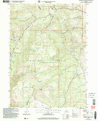
Midnight Mountain, Idaho, USGS topographic map dated 2005.
Includes geographic coordinates (latitude and longitude). This topographic map is suitable for hiking, camping, and exploring, or framing it as a wall map.
Printed on-demand using high resolution imagery, on heavy weight and acid free paper, or alternatively on a variety of synthetic materials.
Topos available on paper, Waterproof, Poly, or Tyvek. Usually shipping rolled, unless combined with other folded maps in one order.
- Product Number: USGS-5433706
- Free digital map download (high-resolution, GeoPDF): Midnight Mountain, Idaho (file size: 13 MB)
- Map Size: please refer to the dimensions of the GeoPDF map above
- Weight (paper map): ca. 55 grams
- Map Type: POD USGS Topographic Map
- Map Series: HTMC
- Map Verison: Historical
- Cell ID: 29157
- Scan ID: 237170
- Imprint Year: 2007
- Woodland Tint: Yes
- Aerial Photo Year: 2006
- Edit Year: 2005
- Datum: NAD83
- Map Projection: Universal Transverse Mercator
- Map published by United States Geological Survey
- Map published by United States Forest Service
- Map Language: English
- Scanner Resolution: 600 dpi
- Map Cell Name: Midnight Mountain
- Grid size: 7.5 X 7.5 Minute
- Date on map: 2005
- Map Scale: 1:24000
- Geographical region: Idaho, United States
Neighboring Maps:
All neighboring USGS topo maps are available for sale online at a variety of scales.
Spatial coverage:
Topo map Midnight Mountain, Idaho, covers the geographical area associated the following places:
- Alpine Spring - Mahogany Basin Spring - Green Basin - Emigration Spring - Danish Flat - Copenhagen Basin - Strawberry Spring - Squirrel Hollow - Dry Fork - Midnight Mountain - Liberty Creek - Log Spring - Mink Creek Spring - Emigration Canyon - Copenhagen Canyon - Relief Society Hollow - Balsam Spring - Emigration Campground - Midnight Lake - Huckleberry Spring - Hells Kitchen Spring - Mahogany Basin - Willow Patch Spring - Dry Basin - Wills Canyon - Pole Canyon - Green Pass Spring - Snow Hollow - Nieber Spring - Green Pass
- Map Area ID: AREA42.37542.25-111.625-111.5
- Northwest corner Lat/Long code: USGSNW42.375-111.625
- Northeast corner Lat/Long code: USGSNE42.375-111.5
- Southwest corner Lat/Long code: USGSSW42.25-111.625
- Southeast corner Lat/Long code: USGSSE42.25-111.5
- Northern map edge Latitude: 42.375
- Southern map edge Latitude: 42.25
- Western map edge Longitude: -111.625
- Eastern map edge Longitude: -111.5


