
~ Mallard Peak ID topo map, 1:24000 scale, 7.5 X 7.5 Minute, Historical, 1994, updated 1997
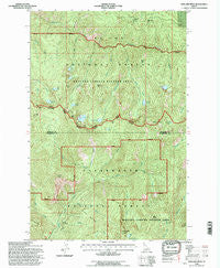
Mallard Peak, Idaho, USGS topographic map dated 1994.
Includes geographic coordinates (latitude and longitude). This topographic map is suitable for hiking, camping, and exploring, or framing it as a wall map.
Printed on-demand using high resolution imagery, on heavy weight and acid free paper, or alternatively on a variety of synthetic materials.
Topos available on paper, Waterproof, Poly, or Tyvek. Usually shipping rolled, unless combined with other folded maps in one order.
- Product Number: USGS-5433462
- Free digital map download (high-resolution, GeoPDF): Mallard Peak, Idaho (file size: 20 MB)
- Map Size: please refer to the dimensions of the GeoPDF map above
- Weight (paper map): ca. 55 grams
- Map Type: POD USGS Topographic Map
- Map Series: HTMC
- Map Verison: Historical
- Cell ID: 70792
- Scan ID: 237018
- Imprint Year: 1997
- Woodland Tint: Yes
- Aerial Photo Year: 1990
- Datum: NAD27
- Map Projection: Lambert Conformal Conic
- Map published by United States Geological Survey
- Map published by United States Forest Service
- Map Language: English
- Scanner Resolution: 600 dpi
- Map Cell Name: Mallard Peak
- Grid size: 7.5 X 7.5 Minute
- Date on map: 1994
- Map Scale: 1:24000
- Geographical region: Idaho, United States
Neighboring Maps:
All neighboring USGS topo maps are available for sale online at a variety of scales.
Spatial coverage:
Topo map Mallard Peak, Idaho, covers the geographical area associated the following places:
- Skyland Lake - Heart Peak - Black Buttes - Northbound Creek - Mallard Larkins Pioneer Park - Jug Creek - Mallard Lake - Wash Creek - Gnat Lake - Crag Peak - Wasset Peak - Cataract Creek - Isabella Point - Goat Creek - Black Mountain - Mud Lake - Northbound Lake - Black Lake - John Creek - Larkins Lake - Crag Lake - Elmer Creek - Falls Creek - Heart Lake - East Sister - Mallard Peak - Old Man Creek - Larkins Peak - Gnat Point - Blue Lake - Hero Lake - Wasset Creek - Martin Creek - Crimper Creek - Black Creek - Greenie Creek - Fawn Lake - Martin Peak - Surveyors Ridge Lookout
- Map Area ID: AREA4746.875-115.625-115.5
- Northwest corner Lat/Long code: USGSNW47-115.625
- Northeast corner Lat/Long code: USGSNE47-115.5
- Southwest corner Lat/Long code: USGSSW46.875-115.625
- Southeast corner Lat/Long code: USGSSE46.875-115.5
- Northern map edge Latitude: 47
- Southern map edge Latitude: 46.875
- Western map edge Longitude: -115.625
- Eastern map edge Longitude: -115.5


