
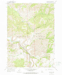
~ Long Gulch ID topo map, 1:24000 scale, 7.5 X 7.5 Minute, Historical, 1964, updated 1966
Long Gulch, Idaho, USGS topographic map dated 1964.
Includes geographic coordinates (latitude and longitude). This topographic map is suitable for hiking, camping, and exploring, or framing it as a wall map.
Printed on-demand using high resolution imagery, on heavy weight and acid free paper, or alternatively on a variety of synthetic materials.
Topos available on paper, Waterproof, Poly, or Tyvek. Usually shipping rolled, unless combined with other folded maps in one order.
- Product Number: USGS-5433361
- Free digital map download (high-resolution, GeoPDF): Long Gulch, Idaho (file size: 15 MB)
- Map Size: please refer to the dimensions of the GeoPDF map above
- Weight (paper map): ca. 55 grams
- Map Type: POD USGS Topographic Map
- Map Series: HTMC
- Map Verison: Historical
- Cell ID: 70737
- Scan ID: 236957
- Imprint Year: 1966
- Woodland Tint: Yes
- Aerial Photo Year: 1959
- Field Check Year: 1964
- Datum: NAD27
- Map Projection: Polyconic
- Map published by United States Geological Survey
- Map Language: English
- Scanner Resolution: 600 dpi
- Map Cell Name: Long Gulch
- Grid size: 7.5 X 7.5 Minute
- Date on map: 1964
- Map Scale: 1:24000
- Geographical region: Idaho, United States
Neighboring Maps:
All neighboring USGS topo maps are available for sale online at a variety of scales.
Spatial coverage:
Topo map Long Gulch, Idaho, covers the geographical area associated the following places:
- Spring Creek - Grape Creek - Elk Creek - Elk Creek Exclosure - Krall Mountain - Jackass Creek - Little Rattlesnake Creek - Graves Creek - Rattlesnake Campground - Rattlesnake Creek - Corral Creek - Boise River Wildlife Management Area - Long Gulch Guard Station - Lower Bench - Timber Creek - Buffalo Creek - Long Gulch - Flatiron Mountain - Big Fiddler Creek - Pony Creek - Smith Creek - Chicken Creek - Crank Creek - Wood Cabin Creek
- Map Area ID: AREA43.62543.5-115.75-115.625
- Northwest corner Lat/Long code: USGSNW43.625-115.75
- Northeast corner Lat/Long code: USGSNE43.625-115.625
- Southwest corner Lat/Long code: USGSSW43.5-115.75
- Southeast corner Lat/Long code: USGSSE43.5-115.625
- Northern map edge Latitude: 43.625
- Southern map edge Latitude: 43.5
- Western map edge Longitude: -115.75
- Eastern map edge Longitude: -115.625


