
~ Hida Point ID topo map, 1:24000 scale, 7.5 X 7.5 Minute, Historical, 1978, updated 1987
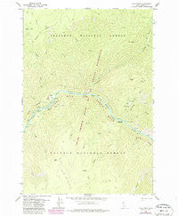
Hida Point, Idaho, USGS topographic map dated 1978.
Includes geographic coordinates (latitude and longitude). This topographic map is suitable for hiking, camping, and exploring, or framing it as a wall map.
Printed on-demand using high resolution imagery, on heavy weight and acid free paper, or alternatively on a variety of synthetic materials.
Topos available on paper, Waterproof, Poly, or Tyvek. Usually shipping rolled, unless combined with other folded maps in one order.
- Product Number: USGS-5432548
- Free digital map download (high-resolution, GeoPDF): Hida Point, Idaho (file size: 12 MB)
- Map Size: please refer to the dimensions of the GeoPDF map above
- Weight (paper map): ca. 55 grams
- Map Type: POD USGS Topographic Map
- Map Series: HTMC
- Map Verison: Historical
- Cell ID: 20321
- Scan ID: 236485
- Imprint Year: 1987
- Woodland Tint: Yes
- Photo Revision Year: 1987
- Aerial Photo Year: 1984
- Edit Year: 1987
- Field Check Year: 1974
- Datum: NAD27
- Map Projection: Transverse Mercator
- Map published by United States Geological Survey
- Map Language: English
- Scanner Resolution: 600 dpi
- Map Cell Name: Hida Point
- Grid size: 7.5 X 7.5 Minute
- Date on map: 1978
- Map Scale: 1:24000
- Geographical region: Idaho, United States
Neighboring Maps:
All neighboring USGS topo maps are available for sale online at a variety of scales.
Spatial coverage:
Topo map Hida Point, Idaho, covers the geographical area associated the following places:
- Salmon River Breaks - Cro Creek - White Bird Meadow - Myers Creek - Big Eddy - Hida Ridge - Bailey Bar - Salt Creek - Raven Creek - Fivemile Rapids - Rainey Point - Silge Creek - Magpie Creek - Allison Ranch - Ladder Creek - Crown Point - Bargamin Bar - Hida Creek - Rattlesnake Creek - Bargamin Rapids - Crofoot Point - Rattlesnake Bar - Magpie Creek Campsite - Cliff Creek - West Fork Rattlesnake Creek - Bargamin Creek - Crow Creek - Crofoot Ranch - Split Rock Rapids - Rainey Creek - Bailey Creek - Magpie Creek District Ranger Station - Bargamin Bar Campsite - Hida Point - Fivemile Creek - Clearwater Mountains - Sapp Creek
- Map Area ID: AREA45.62545.5-115.25-115.125
- Northwest corner Lat/Long code: USGSNW45.625-115.25
- Northeast corner Lat/Long code: USGSNE45.625-115.125
- Southwest corner Lat/Long code: USGSSW45.5-115.25
- Southeast corner Lat/Long code: USGSSE45.5-115.125
- Northern map edge Latitude: 45.625
- Southern map edge Latitude: 45.5
- Western map edge Longitude: -115.25
- Eastern map edge Longitude: -115.125


