
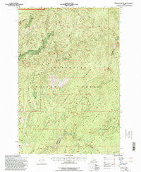
~ Hemlock Butte ID topo map, 1:24000 scale, 7.5 X 7.5 Minute, Historical, 1994, updated 1998
Hemlock Butte, Idaho, USGS topographic map dated 1994.
Includes geographic coordinates (latitude and longitude). This topographic map is suitable for hiking, camping, and exploring, or framing it as a wall map.
Printed on-demand using high resolution imagery, on heavy weight and acid free paper, or alternatively on a variety of synthetic materials.
Topos available on paper, Waterproof, Poly, or Tyvek. Usually shipping rolled, unless combined with other folded maps in one order.
- Product Number: USGS-5432520
- Free digital map download (high-resolution, GeoPDF): Hemlock Butte, Idaho (file size: 18 MB)
- Map Size: please refer to the dimensions of the GeoPDF map above
- Weight (paper map): ca. 55 grams
- Map Type: POD USGS Topographic Map
- Map Series: HTMC
- Map Verison: Historical
- Cell ID: 20062
- Scan ID: 236468
- Imprint Year: 1998
- Woodland Tint: Yes
- Aerial Photo Year: 1990
- Field Check Year: 1994
- Datum: NAD27
- Map Projection: Lambert Conformal Conic
- Map published by United States Forest Service
- Map Language: English
- Scanner Resolution: 600 dpi
- Map Cell Name: Hemlock Butte
- Grid size: 7.5 X 7.5 Minute
- Date on map: 1994
- Map Scale: 1:24000
- Geographical region: Idaho, United States
Neighboring Maps:
All neighboring USGS topo maps are available for sale online at a variety of scales.
Spatial coverage:
Topo map Hemlock Butte, Idaho, covers the geographical area associated the following places:
- Dutchman Creek - Yoosa Creek - Siberia Creek - Thompson Gulch - Pioneer Mine - Rescue Creek - Nelson Creek - Trapper Gulch - Rosebud Creek - Lost Hat Saddle - French Saddle - Gezel Creek - Dan Lee Ridge - Chamook Creek - Armstrong Gulch - Belle Creek - Red Cloud Mine - Belle Creek Campground - Relaskop Creek - Hemlock Butte - Johnson Draw - Dewey Creek - Camp Creek - Jenson Creek - Cole Creek - Greer Gulch - Alder Creek - Sawmill Creek - Big Gulch - Winter Draw - Pistol Grip Mine - Mox Creek
- Map Area ID: AREA46.546.375-115.75-115.625
- Northwest corner Lat/Long code: USGSNW46.5-115.75
- Northeast corner Lat/Long code: USGSNE46.5-115.625
- Southwest corner Lat/Long code: USGSSW46.375-115.75
- Southeast corner Lat/Long code: USGSSE46.375-115.625
- Northern map edge Latitude: 46.5
- Southern map edge Latitude: 46.375
- Western map edge Longitude: -115.75
- Eastern map edge Longitude: -115.625


