
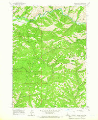
~ Grouse Butte ID topo map, 1:24000 scale, 7.5 X 7.5 Minute, Historical, 1964, updated 1966
Grouse Butte, Idaho, USGS topographic map dated 1964.
Includes geographic coordinates (latitude and longitude). This topographic map is suitable for hiking, camping, and exploring, or framing it as a wall map.
Printed on-demand using high resolution imagery, on heavy weight and acid free paper, or alternatively on a variety of synthetic materials.
Topos available on paper, Waterproof, Poly, or Tyvek. Usually shipping rolled, unless combined with other folded maps in one order.
- Product Number: USGS-5432348
- Free digital map download (high-resolution, GeoPDF): Grouse Butte, Idaho (file size: 15 MB)
- Map Size: please refer to the dimensions of the GeoPDF map above
- Weight (paper map): ca. 55 grams
- Map Type: POD USGS Topographic Map
- Map Series: HTMC
- Map Verison: Historical
- Cell ID: 18640
- Scan ID: 236362
- Imprint Year: 1966
- Woodland Tint: Yes
- Aerial Photo Year: 1959
- Field Check Year: 1964
- Datum: NAD27
- Map Projection: Polyconic
- Map published by United States Geological Survey
- Map Language: English
- Scanner Resolution: 600 dpi
- Map Cell Name: Grouse Butte
- Grid size: 7.5 X 7.5 Minute
- Date on map: 1964
- Map Scale: 1:24000
- Geographical region: Idaho, United States
Neighboring Maps:
All neighboring USGS topo maps are available for sale online at a variety of scales.
Spatial coverage:
Topo map Grouse Butte, Idaho, covers the geographical area associated the following places:
- Virginia Gulch - Willow Creek - Abbot Campground - Cold Spring Creek - Burgy Creek - Lotah Gulch - Bird Creek Campground - Barker Gulch - Taylor Creek - Chaparral Campground - Warm Spring Gulch - Abbot Gulch - Log Chute Gulch - Willow Creek Campground - North Fork Grouse Creek - Ada Gulch - Ok Gulch - Warbois Creek - Gem Gulch - Fox Gulch - Shake Creek Recreation Site - Rough Gulch - Marsh Creek - Soldier Mountains - Swain Gulch - Grouse Butte - Yellow Pine Creek - Buckhorn Creek - South Fork Grouse Creek - Bird Creek - Geum Creek - Lupine Gulch - Kodak Gulch - Middle Fork Grouse Creek - Shake Creek Ranger Station - Sedum Gulch - Shake Creek - Regina Creek - Joan Gulch
- Map Area ID: AREA43.62543.5-115.25-115.125
- Northwest corner Lat/Long code: USGSNW43.625-115.25
- Northeast corner Lat/Long code: USGSNE43.625-115.125
- Southwest corner Lat/Long code: USGSSW43.5-115.25
- Southeast corner Lat/Long code: USGSSE43.5-115.125
- Northern map edge Latitude: 43.625
- Southern map edge Latitude: 43.5
- Western map edge Longitude: -115.25
- Eastern map edge Longitude: -115.125


