
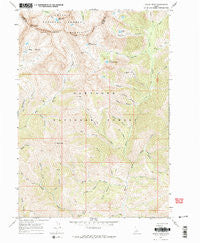
~ Grays Peak ID topo map, 1:24000 scale, 7.5 X 7.5 Minute, Historical, 1967, updated 1971
Grays Peak, Idaho, USGS topographic map dated 1967.
Includes geographic coordinates (latitude and longitude). This topographic map is suitable for hiking, camping, and exploring, or framing it as a wall map.
Printed on-demand using high resolution imagery, on heavy weight and acid free paper, or alternatively on a variety of synthetic materials.
Topos available on paper, Waterproof, Poly, or Tyvek. Usually shipping rolled, unless combined with other folded maps in one order.
- Product Number: USGS-5432294
- Free digital map download (high-resolution, GeoPDF): Grays Peak, Idaho (file size: 17 MB)
- Map Size: please refer to the dimensions of the GeoPDF map above
- Weight (paper map): ca. 55 grams
- Map Type: POD USGS Topographic Map
- Map Series: HTMC
- Map Verison: Historical
- Cell ID: 18254
- Scan ID: 236330
- Imprint Year: 1971
- Woodland Tint: Yes
- Aerial Photo Year: 1966
- Field Check Year: 1967
- Datum: NAD27
- Map Projection: Polyconic
- Map published by United States Geological Survey
- Map Language: English
- Scanner Resolution: 600 dpi
- Map Cell Name: Grays Peak
- Grid size: 7.5 X 7.5 Minute
- Date on map: 1967
- Map Scale: 1:24000
- Geographical region: Idaho, United States
Neighboring Maps:
All neighboring USGS topo maps are available for sale online at a variety of scales.
Spatial coverage:
Topo map Grays Peak, Idaho, covers the geographical area associated the following places:
- Mandolin Creek - Mascot Mine - Aspen Gulch - Brocky Canyon - Talus Gulch - Big Basin - Burks Creek - Pot Creek - Soda Creek - Cabin Gulch - Iron Mine Creek - Box Canyon - Long Gulch - P K Pass - Mud Springs Creek - Grays Peak - Corral Canyon - Upper Box Canyon Lake - Schuss Canyon - Johnstone Pass - Dry Canyon - T P Creek - Windy Lake - Blind Canyon - Grays Creek - Lower Box Canyon Lake - Slide Canyon - Snowslide Gulch - Buckhorn Creek - Pasture Creek - Laidlaw Creek - Chaparral Creek - Arrowhead Lake - Baron Gulch - Old Hyndman Peak - Sunshine Mine
- Map Area ID: AREA43.7543.625-114.125-114
- Northwest corner Lat/Long code: USGSNW43.75-114.125
- Northeast corner Lat/Long code: USGSNE43.75-114
- Southwest corner Lat/Long code: USGSSW43.625-114.125
- Southeast corner Lat/Long code: USGSSE43.625-114
- Northern map edge Latitude: 43.75
- Southern map edge Latitude: 43.625
- Western map edge Longitude: -114.125
- Eastern map edge Longitude: -114


