
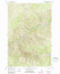
~ Fog Mountain ID topo map, 1:24000 scale, 7.5 X 7.5 Minute, Historical, 1966, updated 1987
Fog Mountain, Idaho, USGS topographic map dated 1966.
Includes geographic coordinates (latitude and longitude). This topographic map is suitable for hiking, camping, and exploring, or framing it as a wall map.
Printed on-demand using high resolution imagery, on heavy weight and acid free paper, or alternatively on a variety of synthetic materials.
Topos available on paper, Waterproof, Poly, or Tyvek. Usually shipping rolled, unless combined with other folded maps in one order.
- Product Number: USGS-5431983
- Free digital map download (high-resolution, GeoPDF): Fog Mountain, Idaho (file size: 20 MB)
- Map Size: please refer to the dimensions of the GeoPDF map above
- Weight (paper map): ca. 55 grams
- Map Type: POD USGS Topographic Map
- Map Series: HTMC
- Map Verison: Historical
- Cell ID: 15689
- Scan ID: 236139
- Imprint Year: 1987
- Woodland Tint: Yes
- Photo Revision Year: 1987
- Aerial Photo Year: 1982
- Edit Year: 1987
- Field Check Year: 1966
- Datum: NAD27
- Map Projection: Polyconic
- Map published by United States Geological Survey
- Map Language: English
- Scanner Resolution: 600 dpi
- Map Cell Name: Fog Mountain
- Grid size: 7.5 X 7.5 Minute
- Date on map: 1966
- Map Scale: 1:24000
- Geographical region: Idaho, United States
Neighboring Maps:
All neighboring USGS topo maps are available for sale online at a variety of scales.
Spatial coverage:
Topo map Fog Mountain, Idaho, covers the geographical area associated the following places:
- Otter Butte - Moose Meadows - Otter Creek - Maiden Creek - Power Creek - Ballinger Creek - Renshaw Creek - Ballinger Point - Mica Creek - Bluff Creek - Tepee Creek - Coon Creek - Fog Mountain - Hidden Creek - Highline Lakes - Bait Creek - Wolf Creek - Birch Creek - Cupboard Creek - Berry Creek - Cascade Creek - Bat Creek - Jims Creek - Highline Ridge - Big Fog Saddle
- Map Area ID: AREA46.12546-115.25-115.125
- Northwest corner Lat/Long code: USGSNW46.125-115.25
- Northeast corner Lat/Long code: USGSNE46.125-115.125
- Southwest corner Lat/Long code: USGSSW46-115.25
- Southeast corner Lat/Long code: USGSSE46-115.125
- Northern map edge Latitude: 46.125
- Southern map edge Latitude: 46
- Western map edge Longitude: -115.25
- Eastern map edge Longitude: -115.125


