
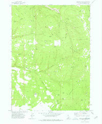
~ Bedstead Ridge ID topo map, 1:24000 scale, 7.5 X 7.5 Minute, Historical, 1973, updated 1976
Bedstead Ridge, Idaho, USGS topographic map dated 1973.
Includes geographic coordinates (latitude and longitude). This topographic map is suitable for hiking, camping, and exploring, or framing it as a wall map.
Printed on-demand using high resolution imagery, on heavy weight and acid free paper, or alternatively on a variety of synthetic materials.
Topos available on paper, Waterproof, Poly, or Tyvek. Usually shipping rolled, unless combined with other folded maps in one order.
- Product Number: USGS-5430488
- Free digital map download (high-resolution, GeoPDF): Bedstead Ridge, Idaho (file size: 9 MB)
- Map Size: please refer to the dimensions of the GeoPDF map above
- Weight (paper map): ca. 55 grams
- Map Type: POD USGS Topographic Map
- Map Series: HTMC
- Map Verison: Historical
- Cell ID: 3016
- Scan ID: 235229
- Imprint Year: 1976
- Woodland Tint: Yes
- Aerial Photo Year: 1972
- Field Check Year: 1973
- Datum: NAD27
- Map Projection: Transverse Mercator
- Map published by United States Geological Survey
- Map Language: English
- Scanner Resolution: 600 dpi
- Map Cell Name: Bedstead Ridge
- Grid size: 7.5 X 7.5 Minute
- Date on map: 1973
- Map Scale: 1:24000
- Geographical region: Idaho, United States
Neighboring Maps:
All neighboring USGS topo maps are available for sale online at a variety of scales.
Spatial coverage:
Topo map Bedstead Ridge, Idaho, covers the geographical area associated the following places:
- Tub Spring - Two Springs - Hells Creek - Buck Spring - Bull Spring - Alto Spring - Fenwick Spring - Lunch Creek - Scott Spring - The Buttes - Summit Springs - Horse Flat - C C C Spring - Bedstead Spring - Stauffer Flat - Juniper Spring - Payne Cabin - Bedstead Ridge - Twin Springs - Manada Flat - Herds V - Post Camp - Granite Springs - Lone Tree Spring - Twin Springs Ridge - Big Willow Spring - Horsehead Spring - Little Willow Spring - Scott Creek - Section Twentyseven Spring - Big Ridge - Summit Springs Creek - Cottonwood Spring - Salt Creek - Dukes Hole
- Map Area ID: AREA42.542.375-117-116.875
- Northwest corner Lat/Long code: USGSNW42.5-117
- Northeast corner Lat/Long code: USGSNE42.5-116.875
- Southwest corner Lat/Long code: USGSSW42.375-117
- Southeast corner Lat/Long code: USGSSE42.375-116.875
- Northern map edge Latitude: 42.5
- Southern map edge Latitude: 42.375
- Western map edge Longitude: -117
- Eastern map edge Longitude: -116.875


