
~ Anderson Butte ID topo map, 1:24000 scale, 7.5 X 7.5 Minute, Historical, 1995, updated 1999
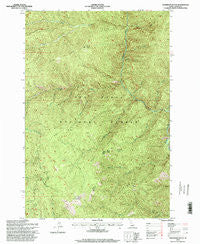
Anderson Butte, Idaho, USGS topographic map dated 1995.
Includes geographic coordinates (latitude and longitude). This topographic map is suitable for hiking, camping, and exploring, or framing it as a wall map.
Printed on-demand using high resolution imagery, on heavy weight and acid free paper, or alternatively on a variety of synthetic materials.
Topos available on paper, Waterproof, Poly, or Tyvek. Usually shipping rolled, unless combined with other folded maps in one order.
- Product Number: USGS-5430240
- Free digital map download (high-resolution, GeoPDF): Anderson Butte, Idaho (file size: 19 MB)
- Map Size: please refer to the dimensions of the GeoPDF map above
- Weight (paper map): ca. 55 grams
- Map Type: POD USGS Topographic Map
- Map Series: HTMC
- Map Verison: Historical
- Cell ID: 970
- Scan ID: 235080
- Imprint Year: 1999
- Woodland Tint: Yes
- Aerial Photo Year: 1992
- Field Check Year: 1995
- Datum: NAD27
- Map Projection: Transverse Mercator
- Map published by United States Forest Service
- Map Language: English
- Scanner Resolution: 600 dpi
- Map Cell Name: Anderson Butte
- Grid size: 7.5 X 7.5 Minute
- Date on map: 1995
- Map Scale: 1:24000
- Geographical region: Idaho, United States
Neighboring Maps:
All neighboring USGS topo maps are available for sale online at a variety of scales.
Spatial coverage:
Topo map Anderson Butte, Idaho, covers the geographical area associated the following places:
- Little Creek - Horse Point - Little Boulder Creek - South Fork Fivemile Creek - Dent Ridge - East Fork Horse Creek - Green Ridge - Horse Ridge - Anderson Butte National Recreation Trail - Horse Creek - East Fork Fivemile Creek - Meadow Creek National Recreation Trail - Sheep Drive Ridge - Fivemile Creek - Doe Creek - Pell Creek - Reverse Creek - Lark Creek - Spur Creek - Indian Hill Creek - West Fork Anderson Creek - Anderson Butte - Pea Creek - Buck Lake Creek - Dent Creek - Spring Creek
- Map Area ID: AREA4645.875-115.375-115.25
- Northwest corner Lat/Long code: USGSNW46-115.375
- Northeast corner Lat/Long code: USGSNE46-115.25
- Southwest corner Lat/Long code: USGSSW45.875-115.375
- Southeast corner Lat/Long code: USGSSE45.875-115.25
- Northern map edge Latitude: 46
- Southern map edge Latitude: 45.875
- Western map edge Longitude: -115.375
- Eastern map edge Longitude: -115.25


