
~ Abes Knob ID topo map, 1:24000 scale, 7.5 X 7.5 Minute, Historical, 1994, updated 1997
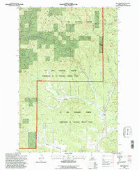
Abes Knob, Idaho, USGS topographic map dated 1994.
Includes geographic coordinates (latitude and longitude). This topographic map is suitable for hiking, camping, and exploring, or framing it as a wall map.
Printed on-demand using high resolution imagery, on heavy weight and acid free paper, or alternatively on a variety of synthetic materials.
Topos available on paper, Waterproof, Poly, or Tyvek. Usually shipping rolled, unless combined with other folded maps in one order.
- Product Number: USGS-5430140
- Free digital map download (high-resolution, GeoPDF): Abes Knob, Idaho (file size: 17 MB)
- Map Size: please refer to the dimensions of the GeoPDF map above
- Weight (paper map): ca. 55 grams
- Map Type: POD USGS Topographic Map
- Map Series: HTMC
- Map Verison: Historical
- Cell ID: 62
- Scan ID: 235021
- Imprint Year: 1997
- Woodland Tint: Yes
- Aerial Photo Year: 1990
- Field Check Year: 1994
- Datum: NAD27
- Map Projection: Lambert Conformal Conic
- Map published by United States Forest Service
- Map Language: English
- Scanner Resolution: 600 dpi
- Map Cell Name: Abes Knob
- Grid size: 7.5 X 7.5 Minute
- Date on map: 1994
- Map Scale: 1:24000
- Geographical region: Idaho, United States
Neighboring Maps:
All neighboring USGS topo maps are available for sale online at a variety of scales.
Spatial coverage:
Topo map Abes Knob, Idaho, covers the geographical area associated the following places:
- Fern Creek - Swamp Creek - Porcupine Creek - Laguna Creek - Pittwood Creek - Flat Creek - Purdue Creek - Purdue - Sheep Creek - Nat Brown Creek - Pee Wee Gulch - Abes Knob - Cougar Meadows - Talapus Creek - Wolf Creek - Mizpah Mine - Cougar Creek - West Fork Potlatch River - Post Creek - Moose Meadows - Highline Creek - Feather Creek
- Map Area ID: AREA4746.875-116.5-116.375
- Northwest corner Lat/Long code: USGSNW47-116.5
- Northeast corner Lat/Long code: USGSNE47-116.375
- Southwest corner Lat/Long code: USGSSW46.875-116.5
- Southeast corner Lat/Long code: USGSSE46.875-116.375
- Northern map edge Latitude: 47
- Southern map edge Latitude: 46.875
- Western map edge Longitude: -116.5
- Eastern map edge Longitude: -116.375


