
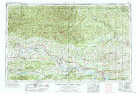
~ Russellville AR topo map, 1:250000 scale, 1 X 2 Degree, Historical, 1984
Russellville, Arkansas, USGS topographic map dated 1984.
Includes geographic coordinates (latitude and longitude). This topographic map is suitable for hiking, camping, and exploring, or framing it as a wall map.
Printed on-demand using high resolution imagery, on heavy weight and acid free paper, or alternatively on a variety of synthetic materials.
Topos available on paper, Waterproof, Poly, or Tyvek. Usually shipping rolled, unless combined with other folded maps in one order.
- Product Number: USGS-5430132
- Free digital map download (high-resolution, GeoPDF): Russellville, Arkansas (file size: 24 MB)
- Map Size: please refer to the dimensions of the GeoPDF map above
- Weight (paper map): ca. 55 grams
- Map Type: POD USGS Topographic Map
- Map Series: HTMC
- Map Verison: Historical
- Cell ID: 68997
- Scan ID: 260607
- Woodland Tint: Yes
- Field Check Year: 1953
- Datum: Unstated
- Map Projection: Transverse Mercator
- Map published by United States Army Corps of Engineers
- Map published by United States Army
- Map Language: English
- Scanner Resolution: 600 dpi
- Map Cell Name: Russellville
- Grid size: 1 X 2 Degree
- Date on map: 1984
- Map Scale: 1:250000
- Geographical region: Arkansas, United States
Neighboring Maps:
All neighboring USGS topo maps are available for sale online at a variety of scales.
Spatial coverage:
Topo map Russellville, Arkansas, covers the geographical area associated the following places:
- London - Sandtown (historical) - Piney - Elberta - Sunny Slope - Witts Springs - Landis - Hawthicket (historical) - Soda Valley - Ludwig - Cypress Valley - Enola - Jamestown - Appleton - Yale - Garrett - Red Rock - Luber - Palisades - Austin - Old Lexington - Caulksville - Linder - South Ozark - Toad Suck - Turkey Creek - Holla Bend - Montana - Sylamore - Kingston - Cave Creek - Crossroads - Spring Valley - Homewood - Middleton - Sand Gap - Gold Creek - Fowler - Rehms Corner - Brannon - Falerno (historical) - Rex - Marsena - Lick Mountain - Southside - Flag - Wooster - Holland - Cravens - Rocky Hill - Twin Groves - Culpepper - Norristown - Saint Vincent - Duncans Gap (historical) - Toney - Magazine - Baker Hollow - Ross - Woolum - Canaan - Mixon - Elba - Worthen - Delaney - Farris Springs - Hammondsville - Harness - Pee Dee - Hagarville - Blue Mountain - Victor - Big Springs - Marshall - Rushing - Hill Creek - Old Neely - Venquin (historical) - Romance - Moab (historical) - Ridgecrest - Jerusalem - Hickory Hill - Stafford - Solgohachia - Rosetta - Whipple - Prairie View - Adona - Greers Ferry - Solo - Sweet Home - Moore - Morrilton - Sunnyside - Riverside - Sommer (historical) - Salem (historical) - Opal - Hickeytown
- Map Area ID: AREA3635-94-92
- Northwest corner Lat/Long code: USGSNW36-94
- Northeast corner Lat/Long code: USGSNE36-92
- Southwest corner Lat/Long code: USGSSW35-94
- Southeast corner Lat/Long code: USGSSE35-92
- Northern map edge Latitude: 36
- Southern map edge Latitude: 35
- Western map edge Longitude: -94
- Eastern map edge Longitude: -92


