
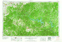
~ Harrison AR topo map, 1:250000 scale, 1 X 2 Degree, Historical, 1964
Harrison, Arkansas, USGS topographic map dated 1964.
Includes geographic coordinates (latitude and longitude). This topographic map is suitable for hiking, camping, and exploring, or framing it as a wall map.
Printed on-demand using high resolution imagery, on heavy weight and acid free paper, or alternatively on a variety of synthetic materials.
Topos available on paper, Waterproof, Poly, or Tyvek. Usually shipping rolled, unless combined with other folded maps in one order.
- Product Number: USGS-5430106
- Free digital map download (high-resolution, GeoPDF): Harrison, Arkansas (file size: 26 MB)
- Map Size: please refer to the dimensions of the GeoPDF map above
- Weight (paper map): ca. 55 grams
- Map Type: POD USGS Topographic Map
- Map Series: HTMC
- Map Verison: Historical
- Cell ID: 68816
- Scan ID: 260592
- Woodland Tint: Yes
- Datum: Unstated
- Map Projection: Transverse Mercator
- Map published by United States Army Corps of Engineers
- Map published by United States Army
- Map Language: English
- Scanner Resolution: 600 dpi
- Map Cell Name: Harrison
- Grid size: 1 X 2 Degree
- Date on map: 1964
- Map Scale: 1:250000
- Geographical region: Arkansas, United States
Neighboring Maps:
All neighboring USGS topo maps are available for sale online at a variety of scales.
Spatial coverage:
Topo map Harrison, Arkansas, covers the geographical area associated the following places:
- Bengal - Protem - Cedarcreek - Cumi - Batavia - Chapman - Vera Cruz - Kissee Mills - Bruno - Pine Branch - Truth (historical) - White City - Rudd - Oregon (historical) - Heritage Estates - Biggs (historical) - Bull Creek - Hammond - Flatwoods - Shepherd of the Hills Estates - Dormis - McFarland (historical) - Iuka - Forsyth - Branson West - Ava - Gobbler - Sycamore Heights - Drury - Wheelerville - Caulfield - Hurd (historical) - Bland - Hurley - Erbie - Garfield - Dillia - Amy - Coin - Huntsville - Oakhill - Sundown - Delmar - Arden - Whitener - Custer (historical) - Oakgrove - Norfork Village - Monett - Monkey Run - Rippee (historical) - Loy - Swan - Seligman - Horton - Conville (historical) - Tunnel (historical) - Basher - Willis - Ponce de Leon - Eastview (historical) - Irma - Hartwell - Huron (historical) - Champion - Foil - Yardelle - Gepp - Maple - Gassville - Ameera (historical) - Arkawana - Blanche - Blue Eye - Rueter - Elijah - Independence (historical) - Leota - Push - Georges Creek - Selmore - Toledo - Advance - Harmony - Hopewell - Walnut Hill - Ozark Beach - Longrun - Elsey - Sycamore Spring - Indian Creek (historical) - Mincy - Mount Perrian (historical) - Lakeland Hills - Evans - Kirbyville - Tanglewood - Summit - Egypt Grove - Mammoth
- Map Area ID: AREA3736-94-92
- Northwest corner Lat/Long code: USGSNW37-94
- Northeast corner Lat/Long code: USGSNE37-92
- Southwest corner Lat/Long code: USGSSW36-94
- Southeast corner Lat/Long code: USGSSE36-92
- Northern map edge Latitude: 37
- Southern map edge Latitude: 36
- Western map edge Longitude: -94
- Eastern map edge Longitude: -92


