
~ Harrison AR topo map, 1:250000 scale, 1 X 2 Degree, Historical, 1945
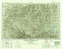
Harrison, Arkansas, USGS topographic map dated 1945.
Includes geographic coordinates (latitude and longitude). This topographic map is suitable for hiking, camping, and exploring, or framing it as a wall map.
Printed on-demand using high resolution imagery, on heavy weight and acid free paper, or alternatively on a variety of synthetic materials.
Topos available on paper, Waterproof, Poly, or Tyvek. Usually shipping rolled, unless combined with other folded maps in one order.
- Product Number: USGS-5430104
- Free digital map download (high-resolution, GeoPDF): Harrison, Arkansas (file size: 27 MB)
- Map Size: please refer to the dimensions of the GeoPDF map above
- Weight (paper map): ca. 55 grams
- Map Type: POD USGS Topographic Map
- Map Series: HTMC
- Map Verison: Historical
- Cell ID: 68816
- Scan ID: 260591
- Aerial Photo Year: 1945
- Datum: NAD27
- Map Projection: Transverse Mercator
- Shaded Relief map: Yes
- Map published by United States Army Corps of Engineers
- Map published by United States Army
- Map Language: English
- Scanner Resolution: 600 dpi
- Map Cell Name: Harrison
- Grid size: 1 X 2 Degree
- Date on map: 1945
- Map Scale: 1:250000
- Geographical region: Arkansas, United States
Neighboring Maps:
All neighboring USGS topo maps are available for sale online at a variety of scales.
Spatial coverage:
Topo map Harrison, Arkansas, covers the geographical area associated the following places:
- Grubb Springs - The Basin - Chastain (historical) - Brownbranch - Pine Branch - Eureka Springs - Sundown - Lakeway - Midway - Powersite - Mincy - Vista Shores - Cartney - Little Buffalo (historical) - Chadwick - Fawn Park - Sycamore - Berryville - Yellville - Freeman (historical) - Lutie - Rambo Riviera - Low Gap - Noble - Dogpatch - Pruitt - Verona - Kingswood Estates - Osborn Crossing - Buffalo City - Oakhill - Fairview - Oakland - Larissa - Wesley - Oto - Elizabeth - Rome - Walden (historical) - Mount Olive - Branson - Boswell - Rea Valley - Bear Creek Springs - Long Beach - Quail - Indian Point - Exeter - Hand (historical) - Hilda - Cricket - Harmony - Girdner - Laytonville (historical) - Loy - Indian Creek (historical) - Old Buffalo - Dodd City - Norwalk - Keystone (historical) - Oakgrove - Osa - Baxter - Metalton - Wells Creek (historical) - Bland - Rockaway Beach - Flag (historical) - McClurg - Grandview - Hopewell - Shipp - Amos - Evening Star - Larue - Nottinghill - Selmore - Olvey - Pleasant Valley - Oldfield - Vera Cruz - Pine Top - Conville (historical) - Galena - Romance - Diamond City - Snow - Wideman - Yocum - Briarcliff - Carrollton - Thuroy - Arrow Point - Mitchell - Verona - Sycamore Heights - Drury - Hocomo - Rudd - Spokane
- Map Area ID: AREA3736-94-92
- Northwest corner Lat/Long code: USGSNW37-94
- Northeast corner Lat/Long code: USGSNE37-92
- Southwest corner Lat/Long code: USGSSW36-94
- Southeast corner Lat/Long code: USGSSE36-92
- Northern map edge Latitude: 37
- Southern map edge Latitude: 36
- Western map edge Longitude: -94
- Eastern map edge Longitude: -92


