
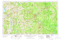
~ El Dorado AR topo map, 1:250000 scale, 1 X 2 Degree, Historical, 1953, updated 1967
El Dorado, Arkansas, USGS topographic map dated 1953.
Includes geographic coordinates (latitude and longitude). This topographic map is suitable for hiking, camping, and exploring, or framing it as a wall map.
Printed on-demand using high resolution imagery, on heavy weight and acid free paper, or alternatively on a variety of synthetic materials.
Topos available on paper, Waterproof, Poly, or Tyvek. Usually shipping rolled, unless combined with other folded maps in one order.
- Product Number: USGS-5430094
- Free digital map download (high-resolution, GeoPDF): El Dorado, Arkansas (file size: 18 MB)
- Map Size: please refer to the dimensions of the GeoPDF map above
- Weight (paper map): ca. 55 grams
- Map Type: POD USGS Topographic Map
- Map Series: HTMC
- Map Verison: Historical
- Cell ID: 76858
- Scan ID: 260586
- Imprint Year: 1967
- Woodland Tint: Yes
- Edit Year: 1966
- Field Check Year: 1953
- Datum: Unstated
- Map Projection: Transverse Mercator
- Map published by United States Army Corps of Engineers
- Map published by United States Army
- Map Language: English
- Scanner Resolution: 600 dpi
- Map Cell Name: El Dorado
- Grid size: 1 X 2 Degree
- Date on map: 1953
- Map Scale: 1:250000
- Geographical region: Arkansas, United States
Neighboring Maps:
All neighboring USGS topo maps are available for sale online at a variety of scales.
Spatial coverage:
Topo map El Dorado, Arkansas, covers the geographical area associated the following places:
- Burtsell - Lilley (historical) - Pine Island Landing - Mount Pleasant - Taylor - Lackland (historical) - Drab (historical) - Millerton - Sumpter - New Hope - Garlandville - Eastridge Addition - Warnock Springs - Mount Holly - Green Acres - Fordyce - Emon - Cole - Bluff City - Boughton - Lester Addition - Beirne - Fouke - Wise (historical) - Emmet - Welcome - Rendezvous - McKamie - Temperanceville - Eagle Mills - Troy - Ferrell (historical) - Blue Bayou - Locust Bayou - Sycamore - Clow - Calhoun - Unity - Carmel - Amy - Free Hope - Sandy Land - Kenova - Kilgore (historical) - Smackover - Kent - Kemp (historical) - Wyloe (historical) - Soco - Young - Harmony Grove - Camden - Buckner - Bodcaw - Lakewood Estates - Chidester - Oak Grove - Lunet - Johnston - Park Addition - Paup - Gravelridge - Mount Elba - Walnut Hill - Pine Grove - Shumaker - Willisville - Bingen - McGlendon Mill - Boyd Hill - Saline - Harbour (historical) - Heine (historical) - New Edinburg - Caney (historical) - Bethel - Temple - Whelen Springs - Tipton - Draughon (historical) - Caledonia - Lydesdale - Jersey - Red Bluff - Fulton - Experiment - Calmer - Sneed (historical) - Farmville - Gertrude - Morris - Sprudel - Herbine - Kress City - Woodlawn - Greenville - Rosston - Jacinto - Dumas City - Serepta Springs (historical)
- Map Area ID: AREA3433-94-92
- Northwest corner Lat/Long code: USGSNW34-94
- Northeast corner Lat/Long code: USGSNE34-92
- Southwest corner Lat/Long code: USGSSW33-94
- Southeast corner Lat/Long code: USGSSE33-92
- Northern map edge Latitude: 34
- Southern map edge Latitude: 33
- Western map edge Longitude: -94
- Eastern map edge Longitude: -92


