
~ Blytheville AR topo map, 1:250000 scale, 1 X 2 Degree, Historical, 1959
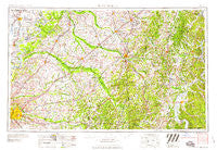
Blytheville, Arkansas, USGS topographic map dated 1959.
Includes geographic coordinates (latitude and longitude). This topographic map is suitable for hiking, camping, and exploring, or framing it as a wall map.
Printed on-demand using high resolution imagery, on heavy weight and acid free paper, or alternatively on a variety of synthetic materials.
Topos available on paper, Waterproof, Poly, or Tyvek. Usually shipping rolled, unless combined with other folded maps in one order.
- Product Number: USGS-5430086
- Free digital map download (high-resolution, GeoPDF): Blytheville, Arkansas (file size: 22 MB)
- Map Size: please refer to the dimensions of the GeoPDF map above
- Weight (paper map): ca. 55 grams
- Map Type: POD USGS Topographic Map
- Map Series: HTMC
- Map Verison: Historical
- Cell ID: 68684
- Scan ID: 260581
- Woodland Tint: Yes
- Field Check Year: 1956
- Datum: Unstated
- Map Projection: Transverse Mercator
- Map published by United States Geological Survey
- Map Language: English
- Scanner Resolution: 600 dpi
- Map Cell Name: Blytheville
- Grid size: 1 X 2 Degree
- Date on map: 1959
- Map Scale: 1:250000
- Geographical region: Arkansas, United States
Neighboring Maps:
All neighboring USGS topo maps are available for sale online at a variety of scales.
Spatial coverage:
Topo map Blytheville, Arkansas, covers the geographical area associated the following places:
- Promised Land - Hurricane Hill - Burlison - Drummonds - Madge - Covington - White Station - Woodville - Woodhill (historical) - Griffen - Union - Jackson - Overton - South Fork - Bethel Springs - Ashport - Sloanville - Bethel - Detroit - Utah - Wilkinsville - Antioch - Maddox - Rock Springs - Fort Pillow - Middleton - Flippin - Gibbs (historical) - Brunswick - Antioch - Wildersville - Walnut Grove - Pattersonville - Curve - Mud Creek - Lakewood - Crucifer - Little John - Saint Peters - Tibbs - Hillville - Howley - Darden - Lacy - Kirk - Dixonville - Cypress - Durhamville - Toone - Whitthorne - Spring Hill - Economy (historical) - Lemsford - Michell (historical) - Graball - Holladay - Tabernacle - Havana - Warrens Bluff - Elba - Cole Ridge - Claybrook - Central - Phillips - Center Point - Hamburg - Cedar Grove (historical) - Beech Bluff - Broadview - Woodland Heights - Crockett Mills - Antioch - Grand Junction - Burton - Leach - Mount Orange - Hickory Withe - Golddust - Pisgah - Blue Goose - Carters Chapel - Walnut Grove - Orysa - Forty Forks - Spain (historical) - Bible Hill - Saint John - Macon - Roby - Sand Ridge - Hicksville - Howard - Jacks Creek - Broadway - Neely - Somerville - West Shiloh - Rossville Junction - Acton - Jeannette
- Map Area ID: AREA3635-90-88
- Northwest corner Lat/Long code: USGSNW36-90
- Northeast corner Lat/Long code: USGSNE36-88
- Southwest corner Lat/Long code: USGSSW35-90
- Southeast corner Lat/Long code: USGSSE35-88
- Northern map edge Latitude: 36
- Southern map edge Latitude: 35
- Western map edge Longitude: -90
- Eastern map edge Longitude: -88


