
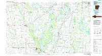
~ Helena AR topo map, 1:100000 scale, 30 X 60 Minute, Historical, 1984, updated 1985
Helena, Arkansas, USGS topographic map dated 1984.
Includes geographic coordinates (latitude and longitude). This topographic map is suitable for hiking, camping, and exploring, or framing it as a wall map.
Printed on-demand using high resolution imagery, on heavy weight and acid free paper, or alternatively on a variety of synthetic materials.
Topos available on paper, Waterproof, Poly, or Tyvek. Usually shipping rolled, unless combined with other folded maps in one order.
- Product Number: USGS-5429808
- Free digital map download (high-resolution, GeoPDF): Helena, Arkansas (file size: 22 MB)
- Map Size: please refer to the dimensions of the GeoPDF map above
- Weight (paper map): ca. 55 grams
- Map Type: POD USGS Topographic Map
- Map Series: HTMC
- Map Verison: Historical
- Cell ID: 72164
- Scan ID: 260414
- Imprint Year: 1985
- Woodland Tint: Yes
- Aerial Photo Year: 1983
- Edit Year: 1984
- Datum: NAD27
- Map Projection: Universal Transverse Mercator
- Planimetric: Yes
- Map published by United States Geological Survey
- Map Language: English
- Scanner Resolution: 600 dpi
- Map Cell Name: Helena
- Grid size: 30 X 60 Minute
- Date on map: 1984
- Map Scale: 1:100000
- Geographical region: Arkansas, United States
Neighboring Maps:
All neighboring USGS topo maps are available for sale online at a variety of scales.
Spatial coverage:
Topo map Helena, Arkansas, covers the geographical area associated the following places:
- Eagle Landing - Bledsoe - Helena-West Helena - Maple Corner - Palestine - Tuttleton - Scott Valley - White Oak - Pink - Barnesville - Aldens - Bowdre - Askew (historical) - Haynes - Hally - Hicksville - KJirksey - Savage - Cypress Corner - Hughes - Kindall - Helena - Holly Hills - Hamlin - Parksplace - Green River - Nesbit - Jeffersonville - Park Place - Austin - Lake Ridge - West Helena - New Hope - Robinsonville - Kelleys Crossing - Linwood - Monica - Blackfoot - Westor - Saint Francis Island Landing - Kincade Bayou (historical) - Holub Crossing - Burnt Cane Crossing - Southaven - Edgewood - Walnut Corner - Smith Corner - Shannondale - Lynchburg - Goode - Rondo - Scaife - Southland - Shepperd Crossing - Lakeside - Evansville - Eudora - Wrightland - Heustess - Phillips Bayou - Buxton - Redfern - Marienette - Pinckney - Seyppel - Hicks - Becks - Lost Lake - Rollinson (historical) - Thomasville - Huma - Latour - Cottonville - Oak Forest - Brickeys - Horseshoe Lake - Evansville - Lake Cormorant - Sarah - Linders Mill (historical) - Mud Lake - Glover - Fox Island - Strayhorn - Haleside - Penton - Belle Meade - Poplar Grove - Turkey Scratch - Little Texas - Hollywood - Rawlinson - Dansby - Crenshaw - West Days - Banks - Commerce Landing - South Plains - Tongin - Arkabutla
- Map Area ID: AREA3534.5-91-90
- Northwest corner Lat/Long code: USGSNW35-91
- Northeast corner Lat/Long code: USGSNE35-90
- Southwest corner Lat/Long code: USGSSW34.5-91
- Southeast corner Lat/Long code: USGSSE34.5-90
- Northern map edge Latitude: 35
- Southern map edge Latitude: 34.5
- Western map edge Longitude: -91
- Eastern map edge Longitude: -90


