
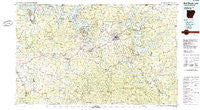
~ Bull Shoals Lake AR topo map, 1:100000 scale, 30 X 60 Minute, Historical, 1985, updated 1985
Bull Shoals Lake, Arkansas, USGS topographic map dated 1985.
Includes geographic coordinates (latitude and longitude). This topographic map is suitable for hiking, camping, and exploring, or framing it as a wall map.
Printed on-demand using high resolution imagery, on heavy weight and acid free paper, or alternatively on a variety of synthetic materials.
Topos available on paper, Waterproof, Poly, or Tyvek. Usually shipping rolled, unless combined with other folded maps in one order.
- Product Number: USGS-5429770
- Free digital map download (high-resolution, GeoPDF): Bull Shoals Lake, Arkansas (file size: 30 MB)
- Map Size: please refer to the dimensions of the GeoPDF map above
- Weight (paper map): ca. 55 grams
- Map Type: POD USGS Topographic Map
- Map Series: HTMC
- Map Verison: Historical
- Cell ID: 67198
- Scan ID: 260394
- Imprint Year: 1985
- Woodland Tint: Yes
- Aerial Photo Year: 1980
- Edit Year: 1985
- Datum: NAD27
- Map Projection: Universal Transverse Mercator
- Map published by United States Geological Survey
- Map Language: English
- Scanner Resolution: 600 dpi
- Map Cell Name: Bull Shoals Lake
- Grid size: 30 X 60 Minute
- Date on map: 1985
- Map Scale: 1:100000
- Geographical region: Arkansas, United States
Neighboring Maps:
All neighboring USGS topo maps are available for sale online at a variety of scales.
Spatial coverage:
Topo map Bull Shoals Lake, Arkansas, covers the geographical area associated the following places:
- Midway - Diamond Bay - Pine Branch - Vidette - Pickren Hall - Kingdom Springs (historical) - Push - Heritage Estates - Flippin - Old Buffalo - Saint Joe - Mount Olive - Briarcliff - Wideman - Maumee - Amos - Stone (historical) - Fairview - Yellville - Everton - Argosy (historical) - Crawford - Colfax - Calico Rock - County Line - Custer (historical) - Shady Grove - Freck - Sycamore Spring - Cotter - Western Grove - Pleasant Ridge - Creswell - Elizabeth - Hepsey (historical) - Tomahawk - Henderson - Big Flat - Clutes (historical) - Rea Valley - Winington - Rally Hill - Powell - Zinc - Vest (historical) - Caney - Forty Four - Spencer (historical) - Old Joe - Mull - Optimus - Herron - Wake (historical) - Mitchell - Woods Point Landing - Olvey - Rodney - Cumi - Mountain Home - Rush - Laytonville (historical) - Dolph - Norfork - Lakeview - Kingswood Estates - Fawn Park - Casteel (historical) - Arkana - Jonesdale (historical) - Bull Shoals - Dugger - Mount Perrian (historical) - Dogwood Park - Clarkridge - Boyle (historical) - Crossroads - Duff - Diamond City - Pineville - Eros - Advance - Hopewell - Cartney - Pyatt - Dugger (historical) - Lead Hill - Ruth - Cowan - Three Brothers - Boswell - Pedlo (historical) - Independence (historical) - Harmon - Lone Rock - Wild Cherry - Ott - Buford - Hand (historical) - Culp - Pleasant Valley
- Map Area ID: AREA36.536-93-92
- Northwest corner Lat/Long code: USGSNW36.5-93
- Northeast corner Lat/Long code: USGSNE36.5-92
- Southwest corner Lat/Long code: USGSSW36-93
- Southeast corner Lat/Long code: USGSSE36-92
- Northern map edge Latitude: 36.5
- Southern map edge Latitude: 36
- Western map edge Longitude: -93
- Eastern map edge Longitude: -92


