
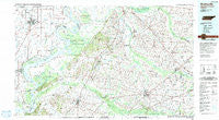
~ Blytheville AR topo map, 1:100000 scale, 30 X 60 Minute, Historical, 1986, updated 1991
Blytheville, Arkansas, USGS topographic map dated 1986.
Includes geographic coordinates (latitude and longitude). This topographic map is suitable for hiking, camping, and exploring, or framing it as a wall map.
Printed on-demand using high resolution imagery, on heavy weight and acid free paper, or alternatively on a variety of synthetic materials.
Topos available on paper, Waterproof, Poly, or Tyvek. Usually shipping rolled, unless combined with other folded maps in one order.
- Product Number: USGS-5429762
- Free digital map download (high-resolution, GeoPDF): Blytheville, Arkansas (file size: 25 MB)
- Map Size: please refer to the dimensions of the GeoPDF map above
- Weight (paper map): ca. 55 grams
- Map Type: POD USGS Topographic Map
- Map Series: HTMC
- Map Verison: Historical
- Cell ID: 67158
- Scan ID: 260390
- Imprint Year: 1991
- Woodland Tint: Yes
- Aerial Photo Year: 1985
- Edit Year: 1986
- Datum: NAD27
- Map Projection: Universal Transverse Mercator
- Map published by United States Geological Survey
- Map published by Tennessee Valley Authority
- Map Language: English
- Scanner Resolution: 600 dpi
- Map Cell Name: Blytheville
- Grid size: 30 X 60 Minute
- Date on map: 1986
- Map Scale: 1:100000
- Geographical region: Arkansas, United States
Neighboring Maps:
All neighboring USGS topo maps are available for sale online at a variety of scales.
Spatial coverage:
Topo map Blytheville, Arkansas, covers the geographical area associated the following places:
- Yarbro - Mack - Stinger - Cairo - Ripley - Oak Grove - Edward Grove - Chestnut Bluff - Calumet - Parker - Lebanon - Owl City - Elizabeth - Double Bridges - Rialto - Cypress - Opossum - Rotan - Detroit - Gilt Edge - Pleasant Hill - Poplar Corner - Eaton - Central - Tigrett - Hickman - Oakview - Brims Corner - Woodland - Willow Grove - Halls - Walnut Grove - Allens - Dogwood - Wolverton (historical) - Elmore - Burton - Brazil - Garland - Dog Hill - Jamestown - Nutbush - Denmark - Bonicord - Fowlkes - Hodson - Three Point - Fruitvale - Richardsons - Hutson Grove (historical) - Union - Stokes - Four Points - Gosnell - Frog Jump - Rosa - Hickman Landing - Luxora - Bells - Saint Peters - Burlison - Michell (historical) - Porters Grove - Nodena - Tuckertown - Jones - Wilcox - Grider - Huffman - Spring Hill - Curve - Poplar Grove - Beaver - Haywood Heights - Number Nine - Fort Pillow - Broadview - Coxville - Golddust - Fulton - Rudolph - Knob Creek - Leighs - Friendship - Upper Nodena (historical) - Blytheville - Covington - New Salem - Shaw - Flippin - Asbury - Crossroads - Alamo - Moran - Tibbs - Maury City - Armorel - Ashport - Belle Eagle - Quail Creek
- Map Area ID: AREA3635.5-90-89
- Northwest corner Lat/Long code: USGSNW36-90
- Northeast corner Lat/Long code: USGSNE36-89
- Southwest corner Lat/Long code: USGSSW35.5-90
- Southeast corner Lat/Long code: USGSSE35.5-89
- Northern map edge Latitude: 36
- Southern map edge Latitude: 35.5
- Western map edge Longitude: -90
- Eastern map edge Longitude: -89


