
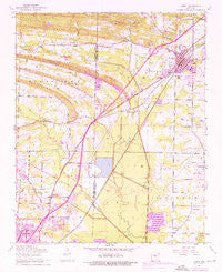
~ Cabot AR topo map, 1:24000 scale, 7.5 X 7.5 Minute, Historical, 1954, updated 1976
Cabot, Arkansas, USGS topographic map dated 1954.
Includes geographic coordinates (latitude and longitude). This topographic map is suitable for hiking, camping, and exploring, or framing it as a wall map.
Printed on-demand using high resolution imagery, on heavy weight and acid free paper, or alternatively on a variety of synthetic materials.
Topos available on paper, Waterproof, Poly, or Tyvek. Usually shipping rolled, unless combined with other folded maps in one order.
- Product Number: USGS-5425498
- Free digital map download (high-resolution, GeoPDF): Cabot, Arkansas (file size: 11 MB)
- Map Size: please refer to the dimensions of the GeoPDF map above
- Weight (paper map): ca. 55 grams
- Map Type: POD USGS Topographic Map
- Map Series: HTMC
- Map Verison: Historical
- Cell ID: 6596
- Scan ID: 258098
- Imprint Year: 1976
- Woodland Tint: Yes
- Photo Revision Year: 1975
- Aerial Photo Year: 1975
- Field Check Year: 1954
- Survey Year: 1941
- Datum: NAD27
- Map Projection: Polyconic
- Map published by United States Geological Survey
- Map Language: English
- Scanner Resolution: 600 dpi
- Map Cell Name: Cabot
- Grid size: 7.5 X 7.5 Minute
- Date on map: 1954
- Map Scale: 1:24000
- Geographical region: Arkansas, United States
Neighboring Maps:
All neighboring USGS topo maps are available for sale online at a variety of scales.
Spatial coverage:
Topo map Cabot, Arkansas, covers the geographical area associated the following places:
- Rolling Hills - Barger Addition - Castle Heights - Cannongate Addition - Deer Creek Subdivision - Kingwood Addition - Cabot - Summit Addition - Meadowlark Addition - Head (historical) - Greyhawk Addition - Bel-Aire Subdivision - The Heights Addition - Southside Addition - Pheasant Run Addition - Kemp Addition - Camilla (historical) - Crestwood - Gladewood Addition - Sunland Estates - Lindulake Addition - Holland - The Meadows Addition - Country Club Addition - Evans Estates - Westbrook Addition - Parnell - Country Lane - Glenwood Estates - Hoover Addition - Willow Lake Subdivision - Mark Lynn Terrace - Waymack Addition - TKO Subdivision - Toneyville - Candlewood Estates - Bailey Estates - Welders Wood - Pinewoods Addition - Southbridge Addition
- Map Area ID: AREA3534.875-92.125-92
- Northwest corner Lat/Long code: USGSNW35-92.125
- Northeast corner Lat/Long code: USGSNE35-92
- Southwest corner Lat/Long code: USGSSW34.875-92.125
- Southeast corner Lat/Long code: USGSSE34.875-92
- Northern map edge Latitude: 35
- Southern map edge Latitude: 34.875
- Western map edge Longitude: -92.125
- Eastern map edge Longitude: -92


