
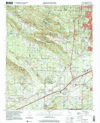
~ Alexander AR topo map, 1:24000 scale, 7.5 X 7.5 Minute, Historical, 1994, updated 2000
Alexander, Arkansas, USGS topographic map dated 1994.
Includes geographic coordinates (latitude and longitude). This topographic map is suitable for hiking, camping, and exploring, or framing it as a wall map.
Printed on-demand using high resolution imagery, on heavy weight and acid free paper, or alternatively on a variety of synthetic materials.
Topos available on paper, Waterproof, Poly, or Tyvek. Usually shipping rolled, unless combined with other folded maps in one order.
- Product Number: USGS-5425020
- Free digital map download (high-resolution, GeoPDF): Alexander, Arkansas (file size: 16 MB)
- Map Size: please refer to the dimensions of the GeoPDF map above
- Weight (paper map): ca. 55 grams
- Map Type: POD USGS Topographic Map
- Map Series: HTMC
- Map Verison: Historical
- Cell ID: 503
- Scan ID: 257854
- Imprint Year: 2000
- Woodland Tint: Yes
- Photo Inspection Year: 1994
- Aerial Photo Year: 1994
- Datum: NAD27
- Map Projection: Lambert Conformal Conic
- Map published by United States Geological Survey
- Map Language: English
- Scanner Resolution: 600 dpi
- Map Cell Name: Alexander
- Grid size: 7.5 X 7.5 Minute
- Date on map: 1994
- Map Scale: 1:24000
- Geographical region: Arkansas, United States
Neighboring Maps:
All neighboring USGS topo maps are available for sale online at a variety of scales.
Spatial coverage:
Topo map Alexander, Arkansas, covers the geographical area associated the following places:
- Tall Timbers West - Martindale - Collegeville - Timber Ridge - Mabelvale - Shiloh - Alexander - Otter Creek - Spring Valley - Red Gate - Banty (historical) - Douglas Corner - Kensington Place - Alpine - Westbrook - Pecan Lake - Terrytown - Twin Springs
- Map Area ID: AREA34.7534.625-92.5-92.375
- Northwest corner Lat/Long code: USGSNW34.75-92.5
- Northeast corner Lat/Long code: USGSNE34.75-92.375
- Southwest corner Lat/Long code: USGSSW34.625-92.5
- Southeast corner Lat/Long code: USGSSE34.625-92.375
- Northern map edge Latitude: 34.75
- Southern map edge Latitude: 34.625
- Western map edge Longitude: -92.5
- Eastern map edge Longitude: -92.375


