
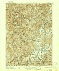
~ Kerby OR topo map, 1:125000 scale, 30 X 30 Minute, Historical, 1917, updated 1942
Kerby, Oregon, USGS topographic map dated 1917.
Includes geographic coordinates (latitude and longitude). This topographic map is suitable for hiking, camping, and exploring, or framing it as a wall map.
Printed on-demand using high resolution imagery, on heavy weight and acid free paper, or alternatively on a variety of synthetic materials.
Topos available on paper, Waterproof, Poly, or Tyvek. Usually shipping rolled, unless combined with other folded maps in one order.
- Product Number: USGS-5424732
- Free digital map download (high-resolution, GeoPDF): Kerby, Oregon (file size: 13 MB)
- Map Size: please refer to the dimensions of the GeoPDF map above
- Weight (paper map): ca. 55 grams
- Map Type: POD USGS Topographic Map
- Map Series: HTMC
- Map Verison: Historical
- Cell ID: 65798
- Scan ID: 283188
- Imprint Year: 1942
- Survey Year: 1915
- Datum: NAD
- Map Projection: Polyconic
- Map published by United States Geological Survey
- Map Language: English
- Scanner Resolution: 600 dpi
- Map Cell Name: Kerby
- Grid size: 30 X 30 Minute
- Date on map: 1917
- Map Scale: 1:125000
- Geographical region: Oregon, United States
Neighboring Maps:
All neighboring USGS topo maps are available for sale online at a variety of scales.
Spatial coverage:
Topo map Kerby, Oregon, covers the geographical area associated the following places:
- Holland - Allentown (historical) - Bridgeview - Dryden - Kerby - Browntown - Takilma - Althouse (historical) - O'Brien - Wonder - Cave Junction - Selma - Brown City (historical)
- Map Area ID: AREA42.542-124-123.5
- Northwest corner Lat/Long code: USGSNW42.5-124
- Northeast corner Lat/Long code: USGSNE42.5-123.5
- Southwest corner Lat/Long code: USGSSW42-124
- Southeast corner Lat/Long code: USGSSE42-123.5
- Northern map edge Latitude: 42.5
- Southern map edge Latitude: 42
- Western map edge Longitude: -124
- Eastern map edge Longitude: -123.5


