
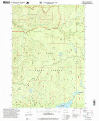
~ Wolf Peak OR topo map, 1:24000 scale, 7.5 X 7.5 Minute, Historical, 1997, updated 1999
Wolf Peak, Oregon, USGS topographic map dated 1997.
Includes geographic coordinates (latitude and longitude). This topographic map is suitable for hiking, camping, and exploring, or framing it as a wall map.
Printed on-demand using high resolution imagery, on heavy weight and acid free paper, or alternatively on a variety of synthetic materials.
Topos available on paper, Waterproof, Poly, or Tyvek. Usually shipping rolled, unless combined with other folded maps in one order.
- Product Number: USGS-5422888
- Free digital map download (high-resolution, GeoPDF): Wolf Peak, Oregon (file size: 13 MB)
- Map Size: please refer to the dimensions of the GeoPDF map above
- Weight (paper map): ca. 55 grams
- Map Type: POD USGS Topographic Map
- Map Series: HTMC
- Map Verison: Historical
- Cell ID: 49671
- Scan ID: 282133
- Imprint Year: 1999
- Woodland Tint: Yes
- Aerial Photo Year: 1995
- Edit Year: 1997
- Survey Year: 1981
- Datum: NAD27
- Map Projection: Lambert Conformal Conic
- Map published by United States Geological Survey
- Map published by United States Forest Service
- Map Language: English
- Scanner Resolution: 600 dpi
- Map Cell Name: Wolf Peak
- Grid size: 7.5 X 7.5 Minute
- Date on map: 1997
- Map Scale: 1:24000
- Geographical region: Oregon, United States
Neighboring Maps:
All neighboring USGS topo maps are available for sale online at a variety of scales.
Spatial coverage:
Topo map Wolf Peak, Oregon, covers the geographical area associated the following places:
- Stein Falls - Wolf Camp Butte - Buck Lake Gravel Pit - Inch Creek - Basin Point Quarry - Linney Creek Recreation Site - Sherar Burn - Little Crater Lake - Frying Pan Quarry - Meditation Point Recreation Site - Anvil Lake - Abbott Burn - Crater Creek - Little Crater Lake Geological Area - Wolf Creek - Dry Meadow - Frying Pan Lake - Linney Creek - Buck Creek Trail - Split Falls - Mud Creek - Meditation Point - Dinger Lake - Draw Creek - Basin Point - Mud Creek Ridge - Black Wolf Meadows - Dinger Creek Trail - String Creek - Jackpot Meadow - Fir Tree Forest Camp - Cooper Creek - Fir Tree Creek - North Arm Recreation Site
- Map Area ID: AREA45.2545.125-121.875-121.75
- Northwest corner Lat/Long code: USGSNW45.25-121.875
- Northeast corner Lat/Long code: USGSNE45.25-121.75
- Southwest corner Lat/Long code: USGSSW45.125-121.875
- Southeast corner Lat/Long code: USGSSE45.125-121.75
- Northern map edge Latitude: 45.25
- Southern map edge Latitude: 45.125
- Western map edge Longitude: -121.875
- Eastern map edge Longitude: -121.75


