
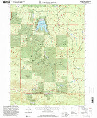
~ Willow Lake OR topo map, 1:24000 scale, 7.5 X 7.5 Minute, Historical, 1997, updated 2000
Willow Lake, Oregon, USGS topographic map dated 1997.
Includes geographic coordinates (latitude and longitude). This topographic map is suitable for hiking, camping, and exploring, or framing it as a wall map.
Printed on-demand using high resolution imagery, on heavy weight and acid free paper, or alternatively on a variety of synthetic materials.
Topos available on paper, Waterproof, Poly, or Tyvek. Usually shipping rolled, unless combined with other folded maps in one order.
- Product Number: USGS-5422840
- Free digital map download (high-resolution, GeoPDF): Willow Lake, Oregon (file size: 17 MB)
- Map Size: please refer to the dimensions of the GeoPDF map above
- Weight (paper map): ca. 55 grams
- Map Type: POD USGS Topographic Map
- Map Series: HTMC
- Map Verison: Historical
- Cell ID: 49252
- Scan ID: 282109
- Imprint Year: 2000
- Woodland Tint: Yes
- Aerial Photo Year: 1994
- Edit Year: 1997
- Survey Year: 1983
- Datum: NAD27
- Map Projection: Lambert Conformal Conic
- Map published by United States Geological Survey
- Map published by United States Forest Service
- Map Language: English
- Scanner Resolution: 600 dpi
- Map Cell Name: Willow Lake
- Grid size: 7.5 X 7.5 Minute
- Date on map: 1997
- Map Scale: 1:24000
- Geographical region: Oregon, United States
Neighboring Maps:
All neighboring USGS topo maps are available for sale online at a variety of scales.
Spatial coverage:
Topo map Willow Lake, Oregon, covers the geographical area associated the following places:
- Juniper Ridge - Indian Creek - Willow Creek Dam - Mosquito Camp - Shake Camp - Willow Prairie - Willow Lake - Miller Gulch - Elder Ranch - Buck Point Trail - Dead End Trail - Horse Creek - McCallister Soda Spring Forest Camp (historical) - Whiskey Spring - Elder Spring - Jack Spring - Bieberstedt Trail - North Fork Bieberstedt Creek - Skeeters Creek - Buck Point Lookout - Bieberstedt Creek - Swamp Creek - Ash Swale - Buck Point Creek - East Branch Willow Creek - Pennington Ranch - Skeeters Swamp - Bieberstedt Butte - Stanley Ranch (historical) - Buck Point - Camp Two - Swamp Creek Reservoir - South Fork Bieberstedt Creek - Indian Glade - Willow Creek Resort - Whiskey Spring Recreation Site - Walch Creek - Nork Creek - Farva Creek - Porcupine Spring - Parker Meadow - Willow Lake County Park - Bear Pan Spring - Cougar Spring - Willow Prairie Recreation Site - Indian Spring - Duel Creek - Shake Camp Spring - West Branch Willow Creek - Cook Burn - Swede Cabin - City of Medford Watershed - Willow Lake Jackson County Boat Ramp - Mosquito Fish Lake Trail
- Map Area ID: AREA42.542.375-122.5-122.375
- Northwest corner Lat/Long code: USGSNW42.5-122.5
- Northeast corner Lat/Long code: USGSNE42.5-122.375
- Southwest corner Lat/Long code: USGSSW42.375-122.5
- Southeast corner Lat/Long code: USGSSE42.375-122.375
- Northern map edge Latitude: 42.5
- Southern map edge Latitude: 42.375
- Western map edge Longitude: -122.5
- Eastern map edge Longitude: -122.375


