
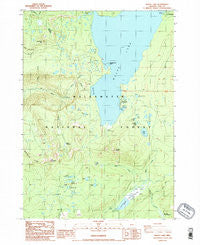
~ Waldo Lake OR topo map, 1:24000 scale, 7.5 X 7.5 Minute, Historical, 1986, updated 1986
Waldo Lake, Oregon, USGS topographic map dated 1986.
Includes geographic coordinates (latitude and longitude). This topographic map is suitable for hiking, camping, and exploring, or framing it as a wall map.
Printed on-demand using high resolution imagery, on heavy weight and acid free paper, or alternatively on a variety of synthetic materials.
Topos available on paper, Waterproof, Poly, or Tyvek. Usually shipping rolled, unless combined with other folded maps in one order.
- Product Number: USGS-5422602
- Free digital map download (high-resolution, GeoPDF): Waldo Lake, Oregon (file size: 13 MB)
- Map Size: please refer to the dimensions of the GeoPDF map above
- Weight (paper map): ca. 55 grams
- Map Type: POD USGS Topographic Map
- Map Series: HTMC
- Map Verison: Historical
- Cell ID: 47230
- Scan ID: 281982
- Imprint Year: 1986
- Woodland Tint: Yes
- Aerial Photo Year: 1982
- Edit Year: 1986
- Field Check Year: 1983
- Datum: NAD27
- Map Projection: Lambert Conformal Conic
- Provisional map: Yes
- Map published by United States Geological Survey
- Map Language: English
- Scanner Resolution: 600 dpi
- Map Cell Name: Waldo Lake
- Grid size: 7.5 X 7.5 Minute
- Date on map: 1986
- Map Scale: 1:24000
- Geographical region: Oregon, United States
Neighboring Maps:
All neighboring USGS topo maps are available for sale online at a variety of scales.
Spatial coverage:
Topo map Waldo Lake, Oregon, covers the geographical area associated the following places:
- Black Meadows - King Lake - Verde Lake - Birthday Lake - Lorin Lake - Deer Camp - Skyline Creek - Lower Island Lake - Gold Lake Recreation Site - Islet Boat Ramp - South Waldo Shelter - Gold Lake - Zircon Lake - Upper Island Lake - Last Lake - Kinglet Lake - Island Lake Trail - Howkum Lake - Maiden Peak Trail - Trio Lake Number 1 - Bongo Lake - Fuji Mountain Trail - Pothole Meadow - Sump Lake - Waldo Lake Trail - Tiny Lake - Cupit Mary Mountain - Koch Mountain - Islet Recreation Site - Klovdahl Bay - Douglas Horse Pasture - Lillian Falls - Deer Camp Lake - Shadow Bay - Jo Ann Lake - Gold Lake Bog - Boo Boo Lake - Full Creek - High Divide Trail - Fig Lake - Sapphire Lake - Shadow Bay Campground Boat Ramp - Shadow Bay Recreation Site - Gold Lake Boat Ramp - Green Lake - Photo Lake - Crain Prairie Trail - Edith Creek - Fuji Mountain - Gold Lake Bog Research Natural Area - Trio Lake Number 3 - Rhododendron Island Recreation Site - Shadow Lake - Elbow Lake - Gold Lake Trail - Nettie Creek - Lower Betty Lake - Cupit Mary Meadow Trail - Klovdahl Creek - Cardiac Lake - Trio Lake Number 2 - Mount Ray Trail - Ray Creek - Mount Ray - Cupit Mary Meadow - Bingo Lake - Betty Lake - Spirit Lake - Emerald Lake - Waldo Lake - Horsefly Lake
- Map Area ID: AREA43.7543.625-122.125-122
- Northwest corner Lat/Long code: USGSNW43.75-122.125
- Northeast corner Lat/Long code: USGSNE43.75-122
- Southwest corner Lat/Long code: USGSSW43.625-122.125
- Southeast corner Lat/Long code: USGSSE43.625-122
- Northern map edge Latitude: 43.75
- Southern map edge Latitude: 43.625
- Western map edge Longitude: -122.125
- Eastern map edge Longitude: -122


