
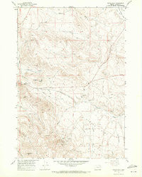
~ Virtue Flat OR topo map, 1:24000 scale, 7.5 X 7.5 Minute, Historical, 1967, updated 1971
Virtue Flat, Oregon, USGS topographic map dated 1967.
Includes geographic coordinates (latitude and longitude). This topographic map is suitable for hiking, camping, and exploring, or framing it as a wall map.
Printed on-demand using high resolution imagery, on heavy weight and acid free paper, or alternatively on a variety of synthetic materials.
Topos available on paper, Waterproof, Poly, or Tyvek. Usually shipping rolled, unless combined with other folded maps in one order.
- Product Number: USGS-5422586
- Free digital map download (high-resolution, GeoPDF): Virtue Flat, Oregon (file size: 12 MB)
- Map Size: please refer to the dimensions of the GeoPDF map above
- Weight (paper map): ca. 55 grams
- Map Type: POD USGS Topographic Map
- Map Series: HTMC
- Map Verison: Historical
- Cell ID: 47003
- Scan ID: 281974
- Imprint Year: 1971
- Aerial Photo Year: 1966
- Field Check Year: 1967
- Datum: NAD27
- Map Projection: Polyconic
- Map published by United States Geological Survey
- Map Language: English
- Scanner Resolution: 600 dpi
- Map Cell Name: Virtue Flat
- Grid size: 7.5 X 7.5 Minute
- Date on map: 1967
- Map Scale: 1:24000
- Geographical region: Oregon, United States
Neighboring Maps:
All neighboring USGS topo maps are available for sale online at a variety of scales.
Spatial coverage:
Topo map Virtue Flat, Oregon, covers the geographical area associated the following places:
- Leo Adler Theatre - Columbia Mine - Virtue Mine - Gray Eagle Mine - Flagstaff Gulch - Virtue Flat - Baker City Division - First Creek - Oregon Trail Historical Monument - Flagstaff Hill - Oregon Trail Historic Interpretive Center Amphitheater - Hidden Treasure Mine - Lone Pine Mountain - White Swan Gulch - Rachel Mine - National Historic Oregon Trail Interpretive Center - Emma Mine - Saint Paul Mine - Con-Virginia Mine - Cliff Mine - Friday Mine - Bureau of Land Management Wastewater Treatment Lagoons - Quartz Gulch - North Fork Ruckles Creek - Flagstaff Mine
- Map Area ID: AREA44.87544.75-117.75-117.625
- Northwest corner Lat/Long code: USGSNW44.875-117.75
- Northeast corner Lat/Long code: USGSNE44.875-117.625
- Southwest corner Lat/Long code: USGSSW44.75-117.75
- Southeast corner Lat/Long code: USGSSE44.75-117.625
- Northern map edge Latitude: 44.875
- Southern map edge Latitude: 44.75
- Western map edge Longitude: -117.75
- Eastern map edge Longitude: -117.625


